How African American Leaders Helped Put People Before Highways in Boston

Enjoying the Southwest Corridor Park (South End) - from the Southwest Corridor Park Facebook page
Walking down the Southwest Corridor Park reveals a lively space with many opportunities for recreation. People walk, ride bikes, skateboard, play basketball, baseball, ice hockey, pickle ball or tennis. Children play on swings and slides, run through sprinklers, and celebrate birthdays in the playgrounds. Gardeners tend their plots in community gardens. The grassy parkland is used for celebrations such as Wake up the Earth and the Bikes Not Bombs fundraising festival. Orange Line stations provide access to mass transit featuring public art that expresses the character of each surrounding area.

Banner on the side of Roxbury Community College (September 2023). Photo by Charlie Rosenberg
The Southwest Corridor Park is one of JP’s many green spaces. It exists because of a grassroots effort to stop Interstate 95 (I-95), a highway which would have cut through large portions of Jamaica Plain and other parts of the city. Residents of suburbs such as Milton and Dedham as well as Cambridge, East Boston, Roxbury, Jamaica Plain, Hyde Park and other parts of Boston came together, showing how neighbors could help determine use of the land in their communities. If not for that success, there would now be an enormous roadway scarring the center of our neighborhood, permanently dividing one side from the other.
Stopping the Highway
But how was the highway stopped? The plan to build it had been pushed by the federal government and approved by many local officials though the 1950s and into the 60s. At first the aim of anti-highway activists was to alter the plans so that the I-95 Interstate would be less disruptive, for example by changing the route or building it below grade level. [1] However, many remembered other anti-development fights which had been lost, resulting in tearing down the New York Streets in the South End, destruction of the West End, and razing of homes in Brighton to make way for the Massachusetts Turnpike. People in many of the affected communities ultimately decided to fight against the idea of the highway cutting though their neighborhoods. [2] A broad-based movement diverse in race, gender and class spent many years agitating against the plan by criticizing the emphasis on automobiles and insisting on transportation alternatives. Not widely recognized is how important African American leadership was in the effort. Byron Rushing, organizer and later a state representative, Mel King as state representative, and especially Chuck Turner as head of the Black United Front (BUF) all helped organize the opposition.
The BUF brought together over 50 African American groups to oppose the highway and to play a greater role in determining what the community wanted to see instead. It spanned a wide ideological range from moderates through the Black Panthers, all of whom wanted to see more local control over their neighborhoods. [3] An example of that leadership was when Chuck Turner held a press conference on the site of what was intended to be the Inner Belt-Southeast Expressway Interchange, which at that point was an empty lot in Roxbury. He held a press release signed by city councilor Tom Atkins and others saying: “There will be no Inner Belt through our community.” [4]
Pressure from the neighborhoods led some officials to question the wisdom of building the highway. In 1970 Massachusetts Governor Francis Sargent held a press conference during which he stated that creating more highways was not working to solve the transportation needs of the city or the state and announced that he would authorize a study on the subject. [5] David Lee of Stull and Lee was the architect who later designed the corridor park and its connection to the public transit system. He says that Governor Sargent looked at the racially mixed mass of people who had shown up for a presentation about the future of the land. The Governor could see that the politically wise move was to stop the highway plan which so many were against. [6] In 1972 Sargent announced his decision. The highway would not be built and instead resources would be put into place to improve the Orange Line of the MBTA mass transit system and support the creation of the corridor park. [7] A plaque outside the Roxbury Crossing station honors the fight against the highway and the community effort to decide how the corridor would be used.

Plaque in the corner of Tremont Street and Columbus Avenue in front of Roxbury Crossing Station. It shows how land was reclaimed along the Southwest Corridor for use by the people of nearby neighborhoods and Greater Boston. Photo by Charlie Rosenberg.
Uniting the neighborhoods
However, even after there was reason to think that the highway might not be built the Department of Public Works continued taking and tearing down houses and commercial properties. [8] [9] [10] The destruction of so many buildings in the corridor left an empty wasteland along Columbus Avenue and Lamartine Street in Jamaica Plain. Many lost housing and places of employment and commerce. Elevated train tracks and their embankment further divided the neighborhood.
Residents came together to brainstorm ideas for the empty space. Chuck Turner formed the Southwest Corridor Land Development Coalition to unite neighborhood groups along the corridor so they could lobby for what they wanted to include. According to Ann Hershfang in Jim Vrabel’s A People’s History of the New Boston, “Turner did a brilliant job of leading a diverse coalition.” One way he succeeded was by supporting only demands that were good for all the groups represented. [11] King, Rushing, Turner and other leaders of the anti-highway movement had opposed I-95 for reasons that went beyond the loss of housing and displacement of those living in the area. They believed in community control, the right of residents to determine what happened to the land where they lived. [12] Those leading the corridor planning process made sure that happened.
Two opportunities helped realize the goals of community groups.

Architect David Lee pointing at site of Orange Line under construction. Photo courtesy of David Lee.
The first was a federal grant from the Model Cities Program which meant the Southwest Corridor Coalition could hire a planner and create a design for the future. The plan included Roxbury Community College (RCC) along with recreational facilities and space for business development. [13]
The second factor was that Governor Sargent won a change to a federal law so that the federal funding could be applied to mass transit instead of a highway as originally intended. [14] That allowed the creation of the park and subway line we have today.
This was the first time that a federal highway which already had funding attached was stopped in its tracks. The subsequent study led to a national model of involving citizens in transportation planning. [15]

Architects David Lee and Harry Ellenzweig; Jackie Hall of Association for Better Housing; and Lydia Mercado of WFEM at Southwest Corridor site. Photo courtesy of David Lee.

Janet Hunkel, community coordinator, speaks with a South End resident at an open house. Photo courtesy of David Lee.
Winning support for the Corridor Park
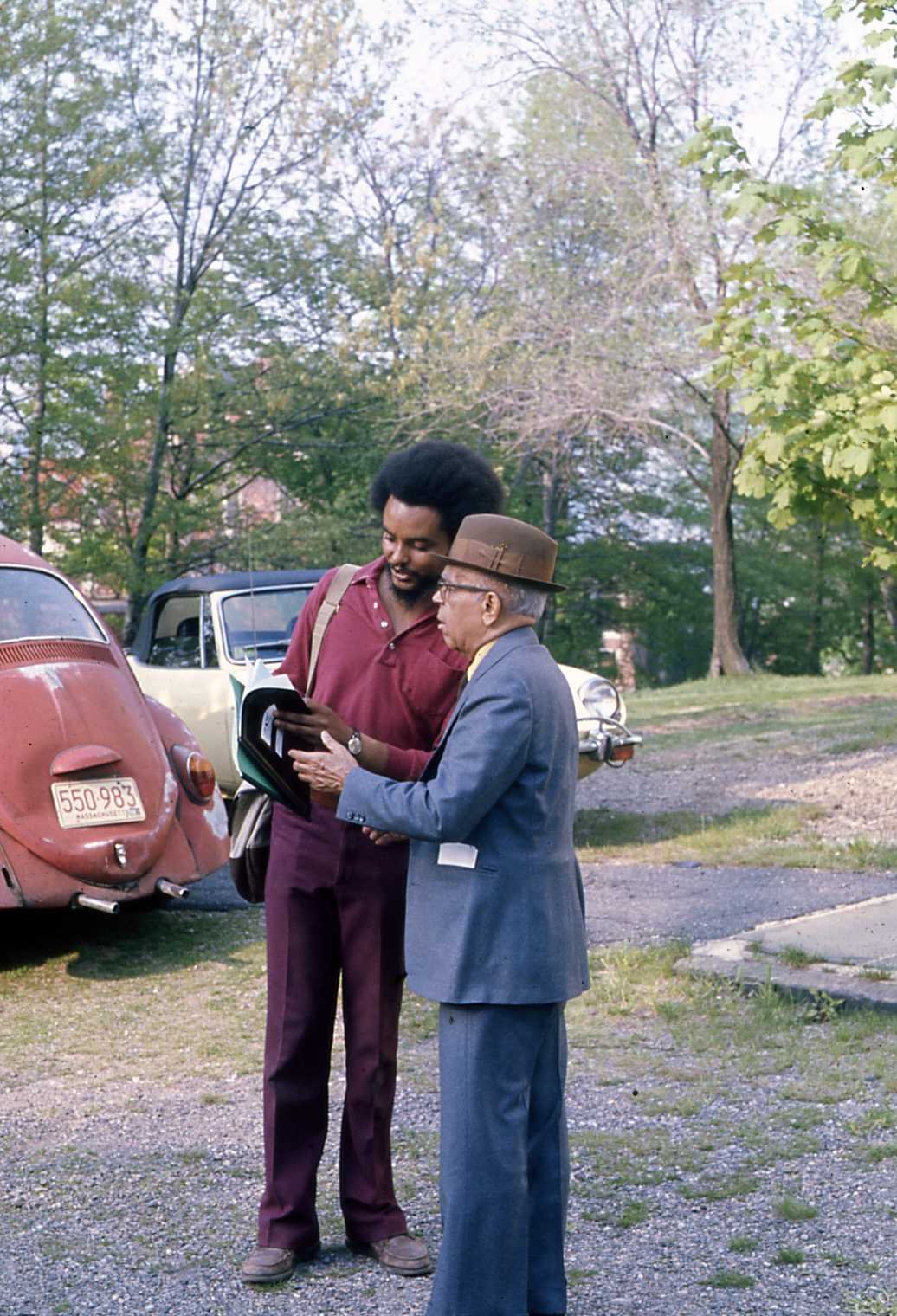
Byron Rushing (who would become a longtime State Representative) on the left confers with another community member. Photo courtesy of David Lee.
Years of effort were required to come up with a design which satisfied the many constituencies bordering the corridor. David Lee eventually devised the plan to create a linear park in the empty space of the corridor. He was inspired by the Emerald Necklace (the linear park designed by Frederick Law Olmstead which runs from the Boston Common through the Fenway and Jamaica Pond to Franklin Park) and envisioned how the corridor could be linked to various cultural, educational, and civic institutions. However, he had a hard time at first convincing residents of the area that a new park was a good idea. He argued that building the park would create jobs in the same way that building the highway would have. [16] [17] Lee later described the program as a community development project with a transportation component because he felt that the creation of the public spaces played such an important part in the project. Using the space for institutions like Roxbury Community College that would stay in place for many decades would also create a sense of permanence. [18]
Planning the park
Just across Columbus Avenue from RCC is another large parcel where several dynamic African American women also played a role in the outcome of the fight against the highway. Their vision for using the vacant strip of land in a way that would enhance the lives of the people who lived there was eventually adopted.
The Bromley Heath Bickford public housing projects located at Centre St and Columbus Avenue in Jamaica Plain were constructed in the 1940s, 1950s and 1960s. Over time they had fallen into disrepair and were seen as dangerous and undesirable places to live. Eventually, the US Office of Economic Opportunity Development proposed a pilot plan for tenant leadership of public housing developments. Tenants at Bromley Heath applied and were selected for the pilot. [19] Mildred Hailey became the executive director of the tenant organization (Tenant Management Corporation or TMC) in charge of running Bromley Heath, the first in the country to be tenant run. The housing project now bears her name and is known as the Mildred C. Hailey Apartments.

Community presentation with Frank Dimella of Dimella Schaffer Architects; Dee Primm, Community Coordinator; and Janet Hurwitz of Stull and Lee Architects. Photo courtesy of David Lee.
Anna Mae Cole was chairwoman of the board of directors of the Bromley Heath tenant organization. Cole spoke in favor of creating an alliance of poor Blacks and Whites to get more of what they were owed in the way of resources. [20] Cole and Hailey helped convince others that a corridor park would be a good use of the space. “The TMC made sure that the Southwest Corridor design reflected the needs and wishes of Bromley Heath residents”. [21] Another example of their leadership in shaping the space around them: originally, developers planned to build a garbage dump and car junkyard in a vacant space next to the housing project. Hailey and Cole instead built a partnership with a developer to create the current mini mall which includes a variety of retail businesses as well as the Stop and Shop grocery store. [22]
In nearby Mission Hill, another African American leader, Alice Taylor, played a role in carrying out a vision for the corridor park. Taylor was a teacher, WWII veteran, entrepreneur, community organizer, and longtime member of the NAACP. She was also president of the Mission Hill Tenants’ Organization and worked with others to decide the location of Ruggles Station. Northeastern University had objected to placing it near its campus because they worried about entry to the campus by those the university considered undesirable. Alice Taylor and other advocates insisted on placing the station where it is today. Because of their persistence both the University and Mission Hill housing communities have access to the commuter rail, Orange Line, and bus routes. A small amphitheater with Taylor’s name was created on a site near the Police headquarters building and the Mission Hill housing units, which were renamed the Alice Taylor Housing Development. [23]

Southwest Corridor map from the Great Runs website.

Image from Massachusetts Department of Conservation and Recreation. This map shows uses of the parkland along the corridor.

Portal fencing diagram produced for Corridor Urban Design Manual by Stull and Lee Architects. Courtesy of David lee.
Including the Community
The original plan for creating the Corridor Park included a mandate for community participation. The Southwest Corridor project coordinator was responsible for collecting ideas and building consensus. David Lee has pictures showing people in the South End planting the gardens that line the park near St. Botolph Street and he emphasizes the communal nature of the decision-making process of what the park would include. [24] A robust volunteer program provided services such as mowing, watering, weeding, planting, and clean up. In People before Highways Karilyn Crockett describes a scene from a planning meeting in Jamaica Plain in which residents debate whether a baseball field or a swimming pool should be built in the JP section of the park. There is no consensus by the end of the discussion, but many people have had a chance to voice their opinions. [25]
During the struggle to defeat the highway, residents showed how they wanted the corridor space used by actually creating temporary buildings: an amphitheater in the South End’s Braddock Park; small structures at the intersection of what would have been the highway and the Inner Belt which include a clinic built by the Black Panthers, a job recruitment center built by the Urban League, and a community information center built by the Black United Front; a skating rink at Bromley housing project; and community gardens in Jamaica Plain. [26]

Rendering of Green Street Station by Sy Mintz and Associates. Courtesy of David Lee.

Model of the Stony Brook Station, originally named Boylston but renamed by the community. The Wake Up the Earth Festival has been held at this location since 1987. Courtesy of David Lee.
The section of the park in Jamaica Plain was finished in time for Wake up the Earth in May of 1987, and a final ribbon cutting for the entire Southwest Corridor Park took place in 1990. People of Boston had proved that they could come together to build and maintain a sustainable and livable environment. Over time the corridor park has grown, been tended by neighbors, and has come to unite different communities. Far from being the source of problems and division some saw when it was first proposed, it has been a unifying force knitting together different strands of the city. Its success is due in large part to the African Americans who led the struggle against the highway and helped organize and plan for the park which took its place and enhances our community today.
This article was written by a volunteer researcher associated with the Hidden Jamaica Plain history project and is based on materials available at the time of publication. Information may change as research continues and more materials are uncovered.
Editor’s Note: Readers may also be interested in the presentation by Jim Vrabel and a panelist of activists about the fight against the I-95 highway.
End Notes
[1] Jim Vrable, A People’s History of the New Boston (Amherst and Boston: University of Massachusetts Press, 2014) p. 142
[2] Karilyn Crockett, People before Highways: Boston Activists, Urban Planners, and a New Movement for City Making (Amherst and Boston: University of Massachusetts Press, 2018) p.15, p. 32
[3] People before Highways p. 39
[4] Alan Lupo, Frank Colcord, Edmund P. Fowler, Rites of Way The politics of Transportation in Boston and the U.S. City (Boston: Little, Brown and Company, 1971) p. 58
[5] People before Highways p. 107
[6] Interview with David Lee conducted by the author, May 5, 2023
[7] People before Highways p.130
[8] Rites of Way p. 57
[9] People before Highways p. 73
[10] A People’s history of the new Boston by Jim Vrabel p. 147
[11] A people’s history of the new Boston p.147
[12] People before Highways p. 104
[13] People before Highways p. 147
[14] People before Highways p. 132
[15] People before Highways p. 133
[16] People before Highways p. 190
[17] Interview with David Lee
[18] Interview with David Lee
[19] People before Highways p. 145
[20] People before Highways p. 143
[21] People before Highways p. 145
[22]We the People media interview. Public housing publication January 1, 1998
[23] People before Highways pp. 190-191
[24] Interview with David Lee
[25] People before Highways pp. 176-177
[26] People before Highways p. 83 and p. 153