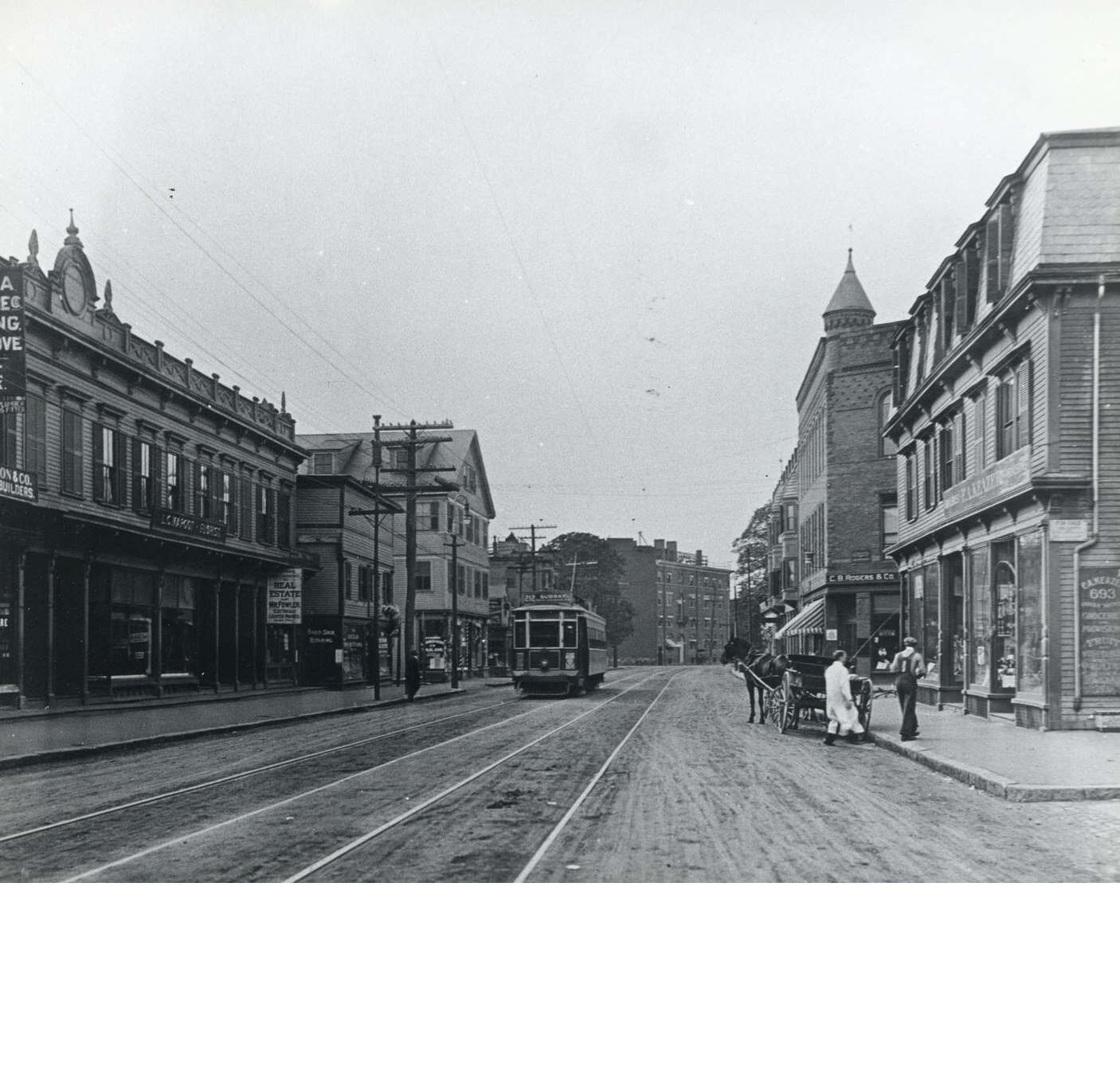
Two men unload a wagon at Centre and Burroughs Streets. City of Boston Archives. Download
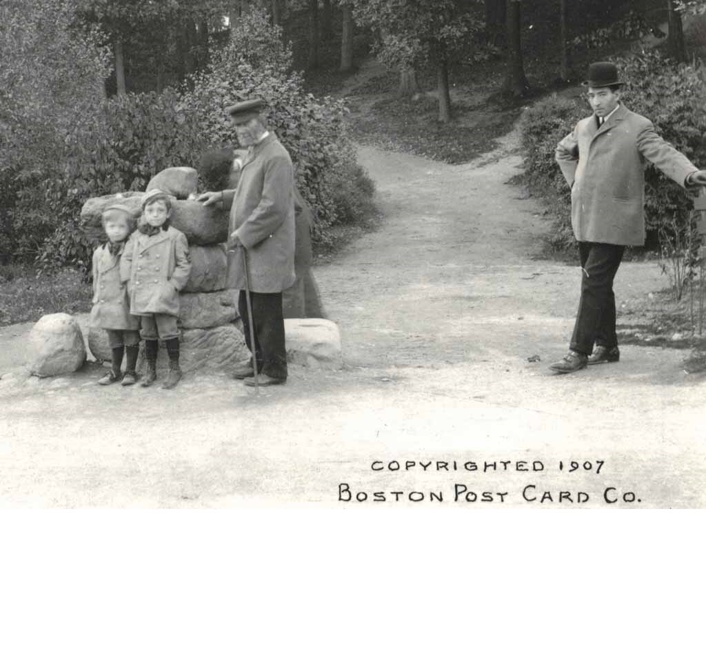
Healing Spring, Franklin Park. JPHS archives.
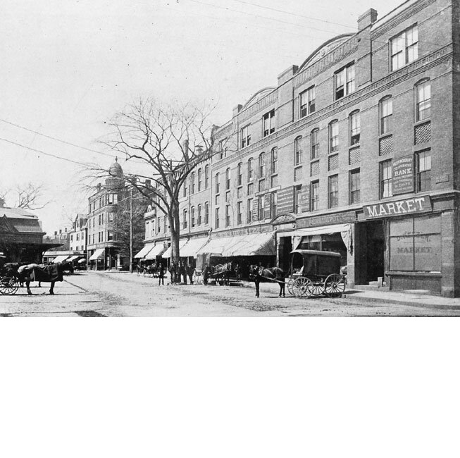
The Woolsey Block in 1895. Courtesy of William Dillon.
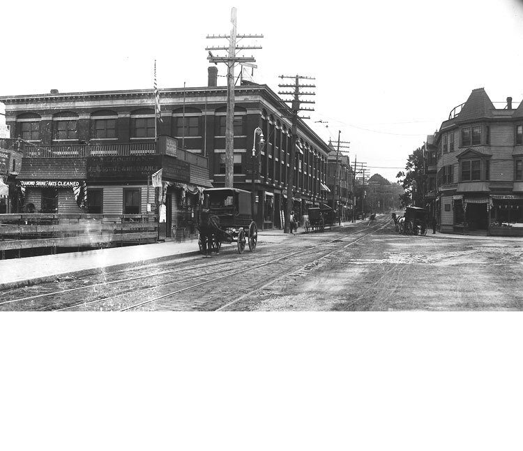
Looking south on Hyde Park Ave at Forest Hills. The Minton Block on left, Morton Block on right. Courtesy of David Rooney.
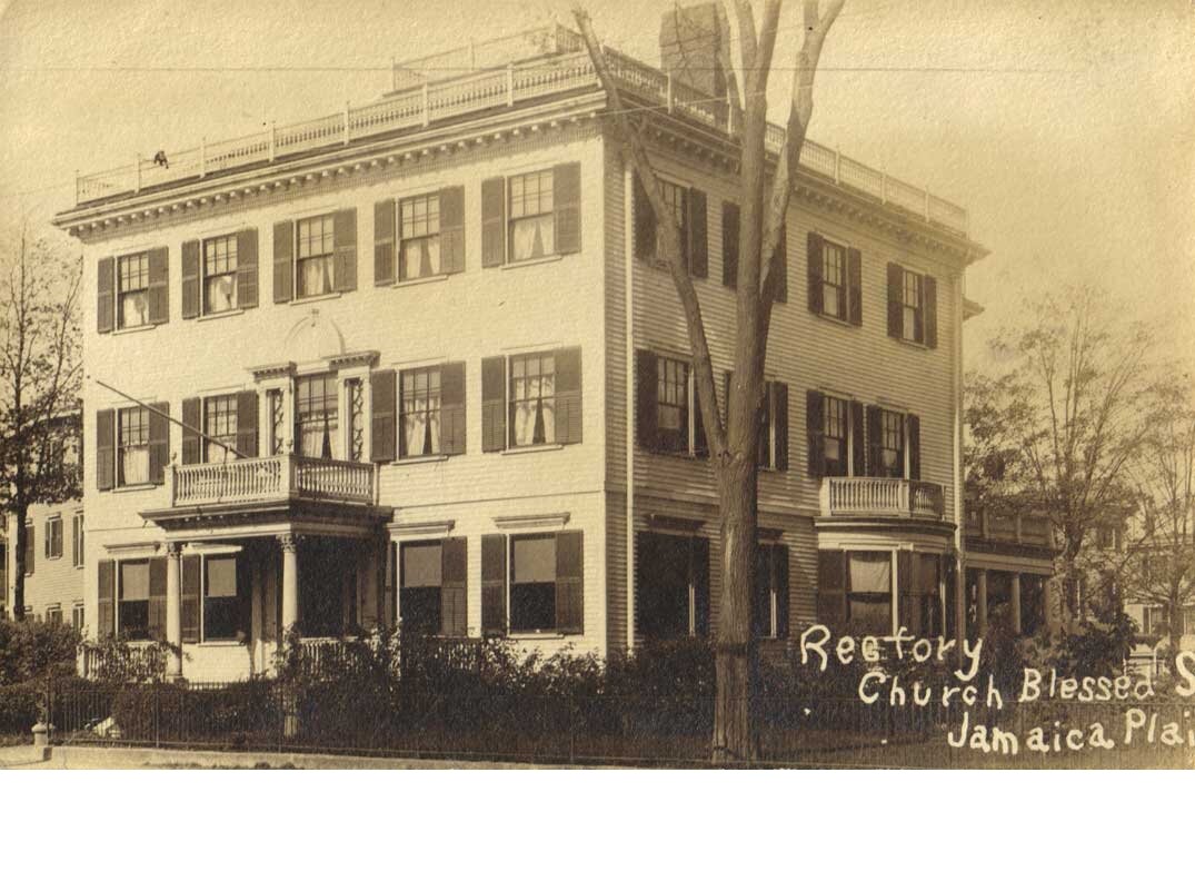
Blessed Sacrament Rectory. From a photo postcard. Jamaica Plain Historical Society archives.
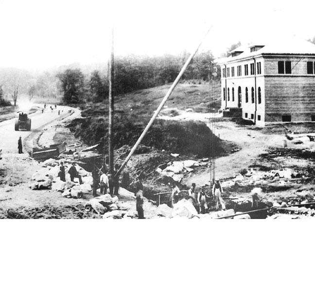
Workers at the Arnold Arboretum visitor's center at the turn of the century. Photograph courtesy of Boston Public Library.
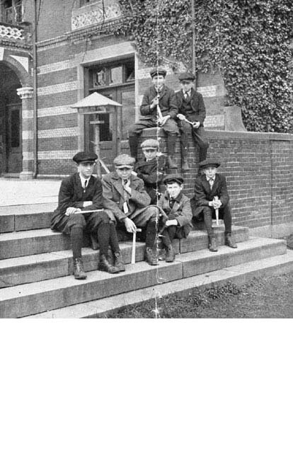
Boys from a geology class at the Children's Museum ready for a field trip led by Robert W. Sayles. Courtesy West Roxbury Highschool 1915
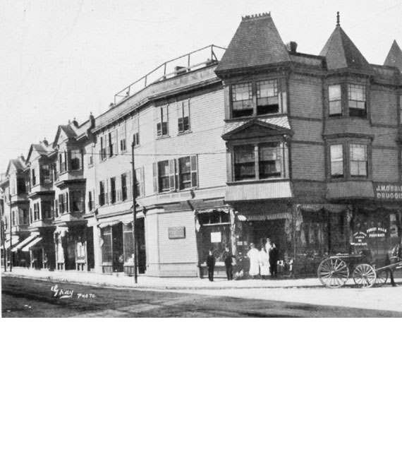
Morton Block built in 1881 at Hyde Park Ave and Washington Street. Photograph courtesy of the West Roxbury Historical Society.
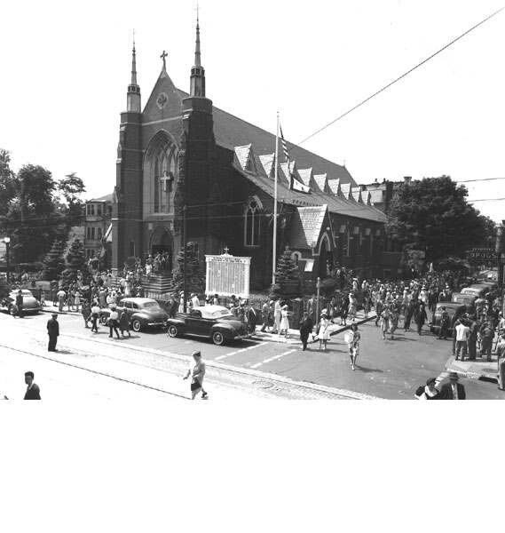
Parishioners leave Saint Thomas Aquinas Church after Sunday mass during World War II. The church was built in 1873 at the corner of South and Saint Joseph Streets.
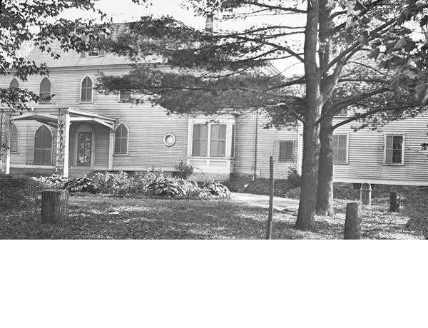
1893 view of the Lyman House (Moreland Cottage) taken by the Olmsted Brothers. Courtesy of the Frances Loeb Library, Harvard University.
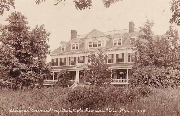
One of the Adams Nervine Asylum buildings.
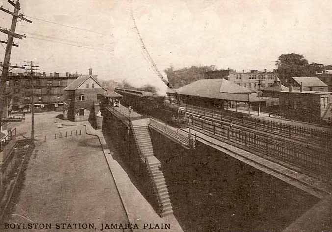
Boylston Station was located near the current site of the Stony Brook MBTA Orange Line Station.
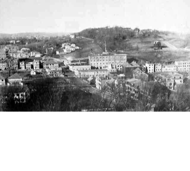
In this view of breweries and factories along the Stony Brook Valley, a portion of Mission Hill can be seen in the background. Courtesy of the Boston Public Library.
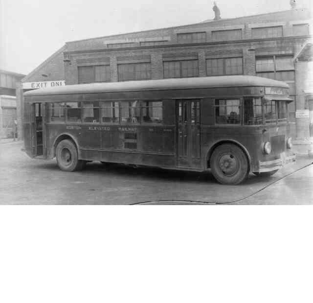
A city bus operated by the Boston Elevated Railway sits outside the Forest Hills station in 1930. Courtesy Anthony Sammarco.
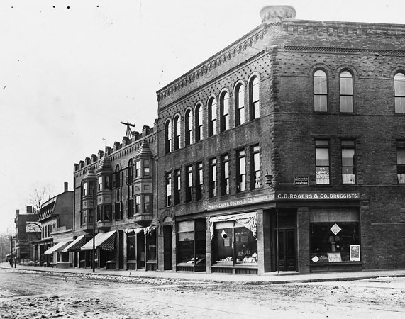
701 and 703 Centre St. at the corner with Burroughs St. At the turn of the century this building housed C.B. Rogers & Company pharmacy and it remained in that use through the mid-1970s.
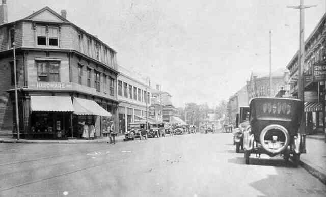
This 1920s view looks north on Centre St. from Burroughs St. towards Seaverns Ave. The corner building on the left is a hardware store. Courtesy of Boston Public Library.
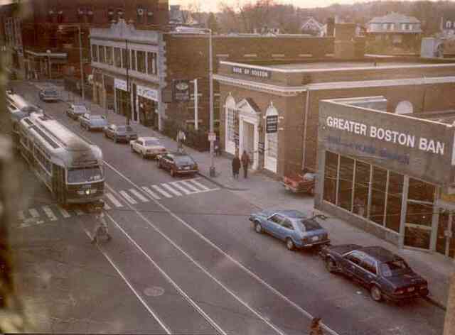
This 1980s view of Centre St. looks south from Seaverns Ave. towards Burroughs St. Courtesy of Fran Perkins.
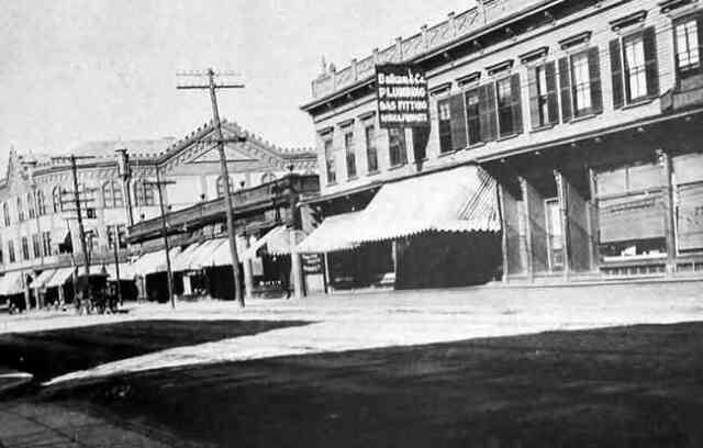
A view of Centre St. looking north towards Seaverns Ave. A plumbing and gas fitting service is seen on the right. circa 1900-1920. Courtesy of the Jamaica Plain Branch of the Boston Public Library.
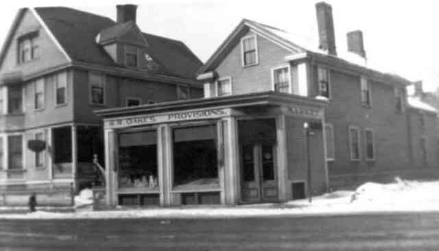
Oakes Provisions stood at the corner of Thomas and Centre Streets. Courtesy of Florence Oakes.
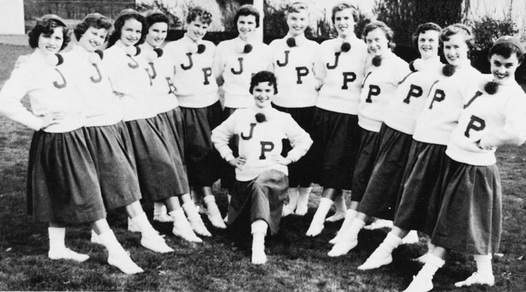
Cheerleaders of the Jamaica Plain High School in 1956. From the JPHS yearbook.
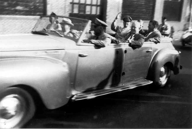
MacArthur's motorcade in 1951 on Columbus Avenue approaching Whittier Street. Photograph by Edwina Schoen, courtesy of Chuck Schoen.
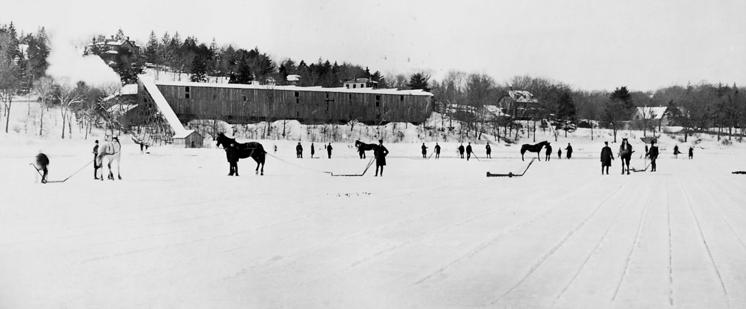
Men at Jamaica Pond stand with horse-drawn sleds used to move the ice to the icehouses. Photograph courtesy of the Boston Public Library.
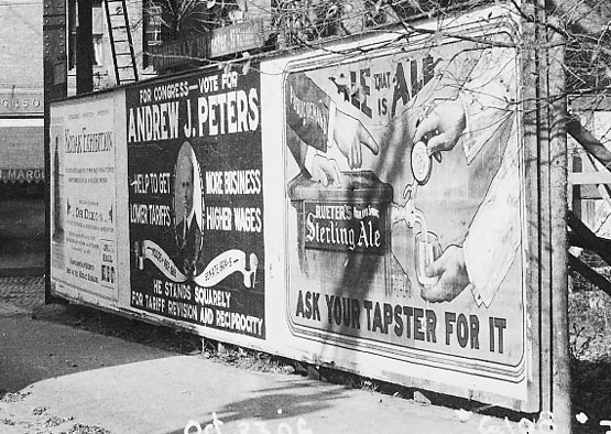
A billboard at Green and Washington Streets. At the center is a campaign poster for Andrew J. Peters for Congress. Photograph courtesy of David Rooney.
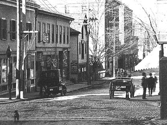
A 1906 view looking down Green St. towards Amory St. Washington St. crosses in the foreground. Current addresses shown in this view run from 171 to 209 Green St.
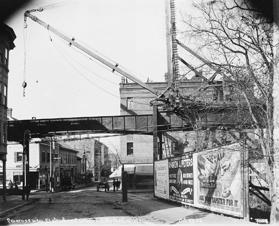
By 1906, the Elevated Railway (the old Orange line) had reached Green and Washington Streets. Photograph courtesy of David Rooney.
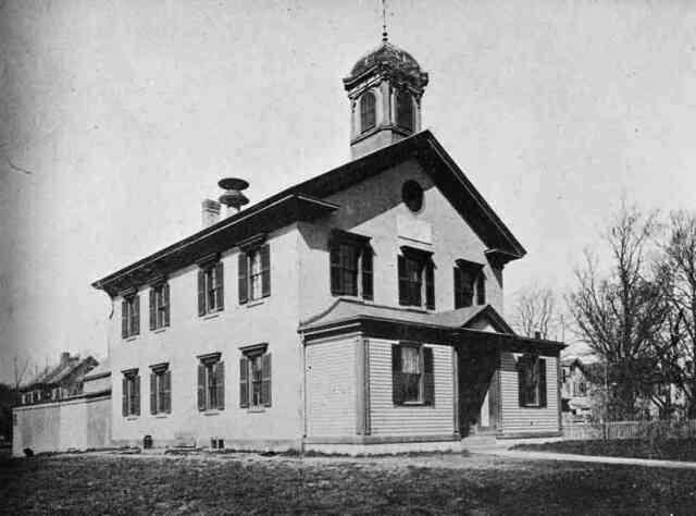
The Eliot School is one of the oldest, continuously running, educational institutions in the United States.
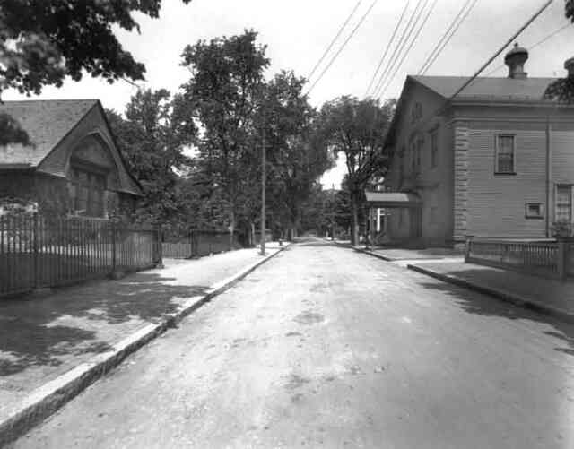
Eliot St. looking from Centre St. towards Hagar St. Eliot Hall, home of the Footlight Club is shown on the right and the parish hall of the First Church on the left.
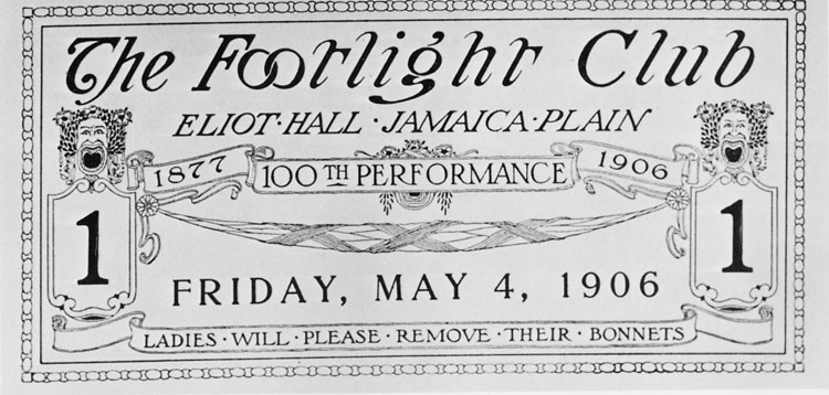
A ticket for the 100th performance at the Footlight Club on Eliot Street. This 1906 ticket requests that, "Ladies will please remove their bonnets."
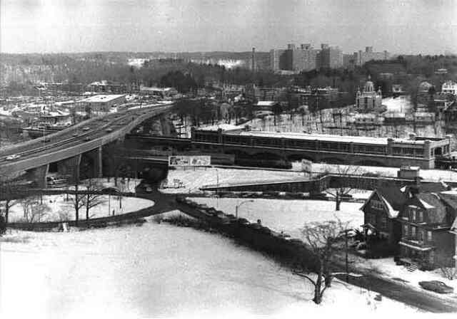
Morton St. overpass and the old Forest Hills Station. Late 1980s.
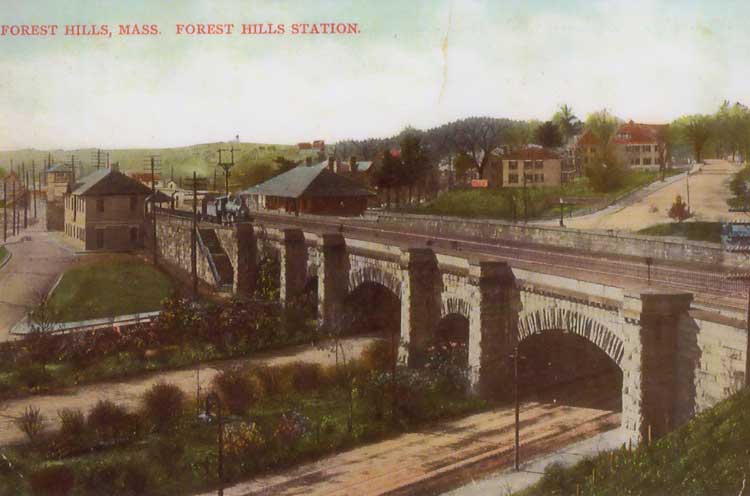
The overpass and station at Forest Hills.
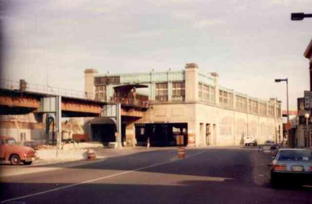
The Forest Hills Orange Line station in the early 1980s shortly before it was torn down to make way for the new Orange Line.
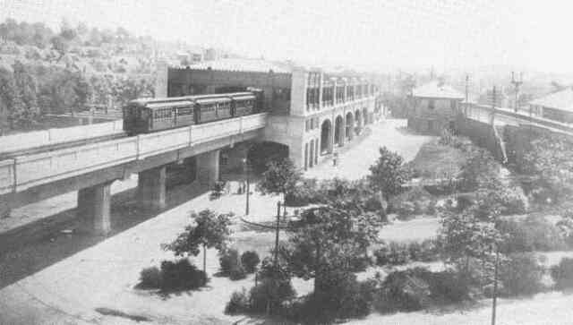
An elevated train leaves the newly completed Forest Hills station in 1908.
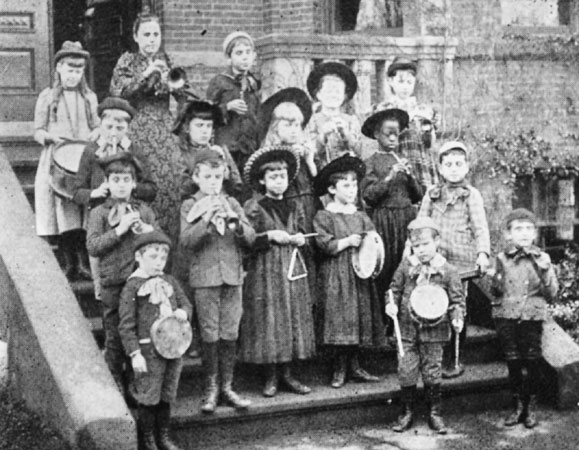
Music students at the Perkins Institution for the Blind. Located at the corner of Pekins and Day Streets in Hyde Square, the school was founded in 1887 and served children through age nine.
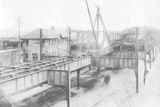
Construction work nears completion on the Forest Hills Orange Line station in 1908. The Boston & Providence Railroad station is seen on the left.
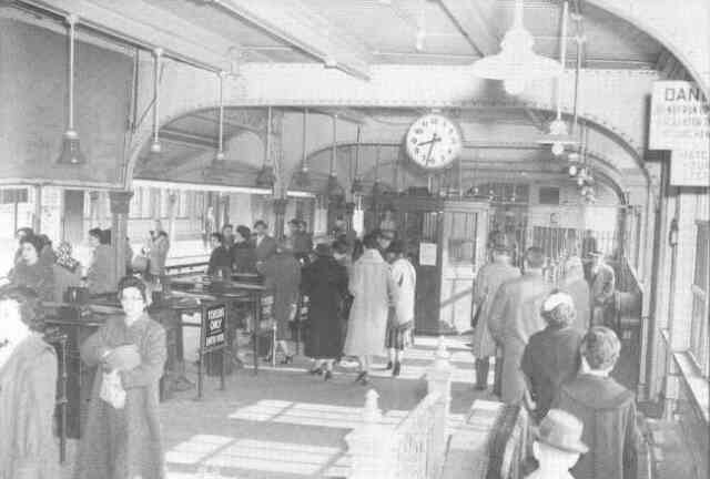
This photograph captures early morning activity inside the Forest Hills Orange Line station in 1960. Courtesy of Anthony Sammarco.
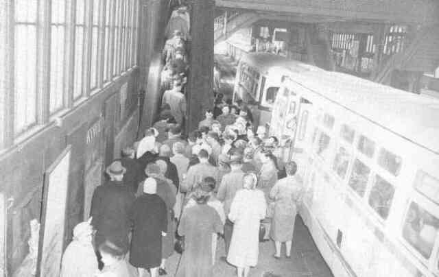
Buses unload passengers on the lower level of the Forest Hills Orange Line station in 1960. Courtesy of Anthony Sammarco.
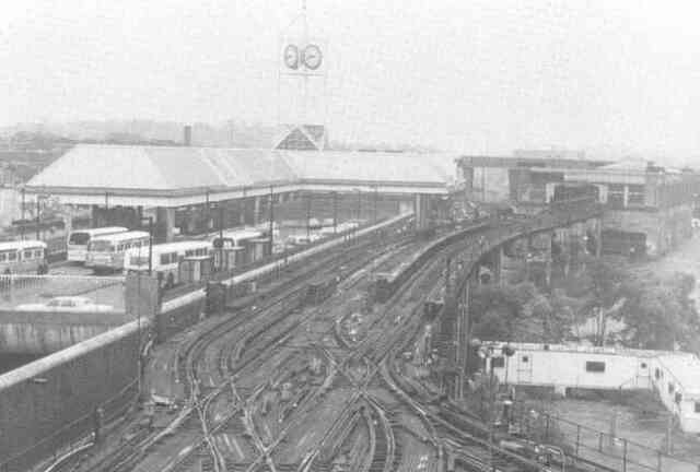
The newly opened Forest Hills Orange Line station is shown on the left in this 1987 photograph while the old station, being readied for demolition, is seen on the right.
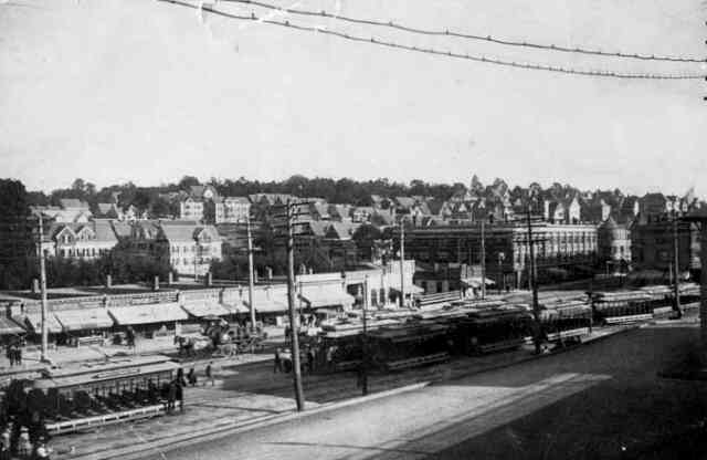
Open trolley cars, used exclusively during the summer months, fill a siding along Washington St. at Forest Hills circa 1900.
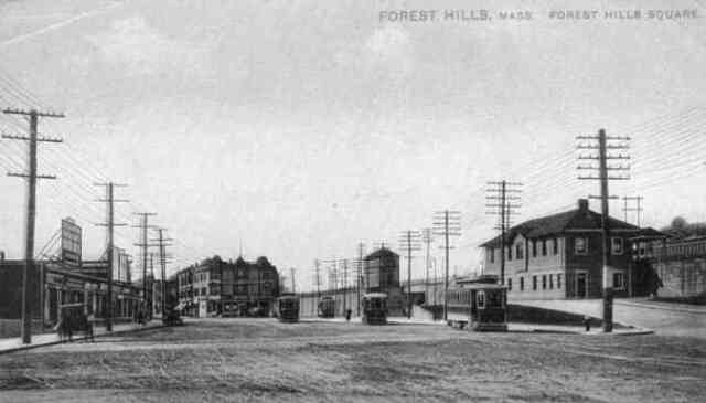
The Forest Hills station of the Boston & Providence Railroad.
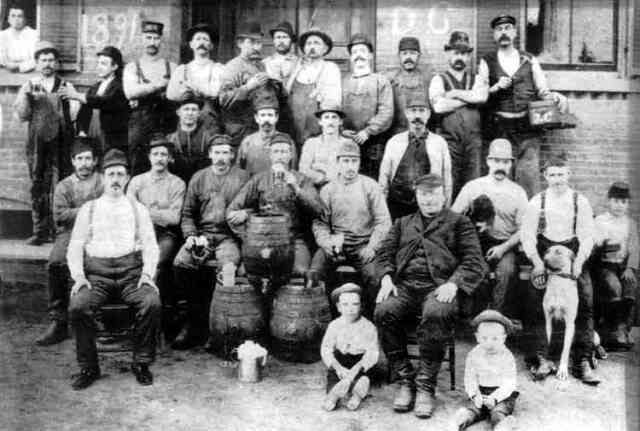
Workers at the Haffenreffer brewery pose outside the plant along with some of their children and a pet in this 1891 photograph. Courtesy of the Boston Public Library.
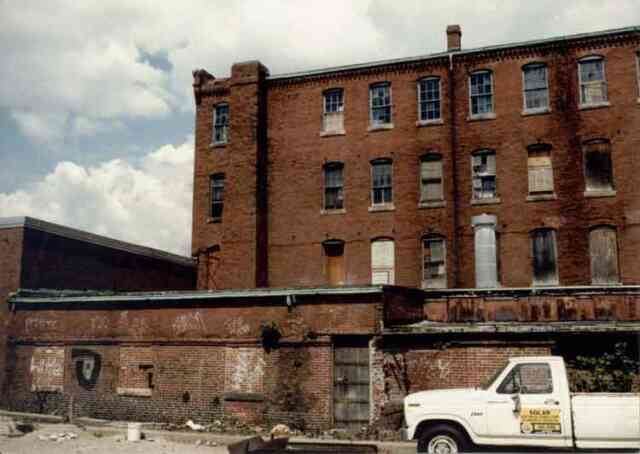
This early 1980s photograph shows building "P" at the Haffenreffer brewery complex just before renovations on the building began. Courtesy of the Jamaica Plain Neighborhood Development Corporation.
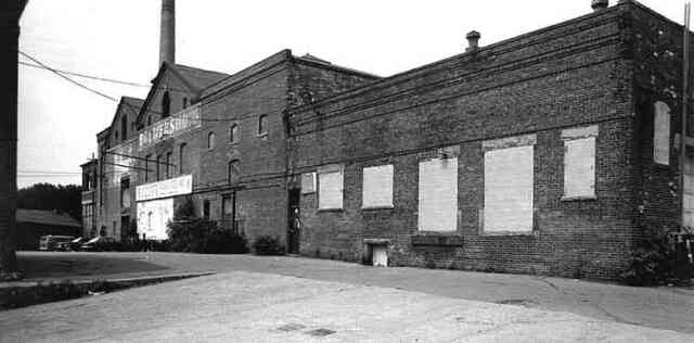
This early 1980s photograph shows the main building the Haffenreffer brewery complex just before renovations on the building began. Courtesy of the Jamaica Plain Neighborhood Development Corporation
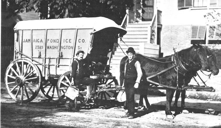
This photograph shows two delivery men using ice tongs to hold blocks of ice cut to the proper size to fit into iceboxes. Photograph courtesy of the Boston Public Library.
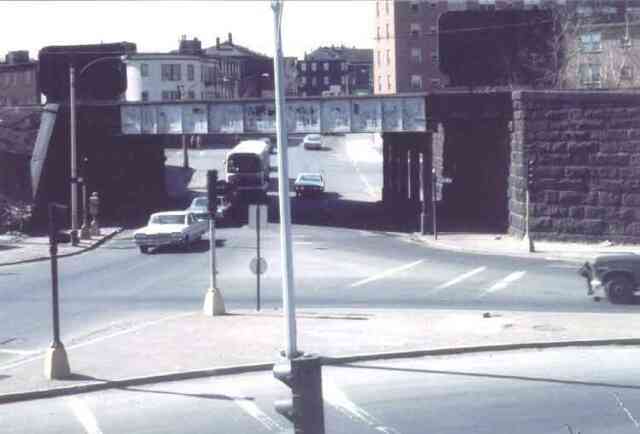
Jackson Square circa 1960. The white building at the top left of the photograph is at the corner of Lamartine and Centre Streets. Courtesy of the Jamaica Plain Neighborhood Development Corporation.
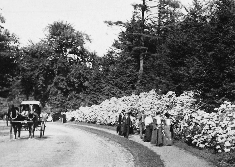
Visitors to the Arnold Arboretum at the turn of the century pass by a display of mountain laurel.
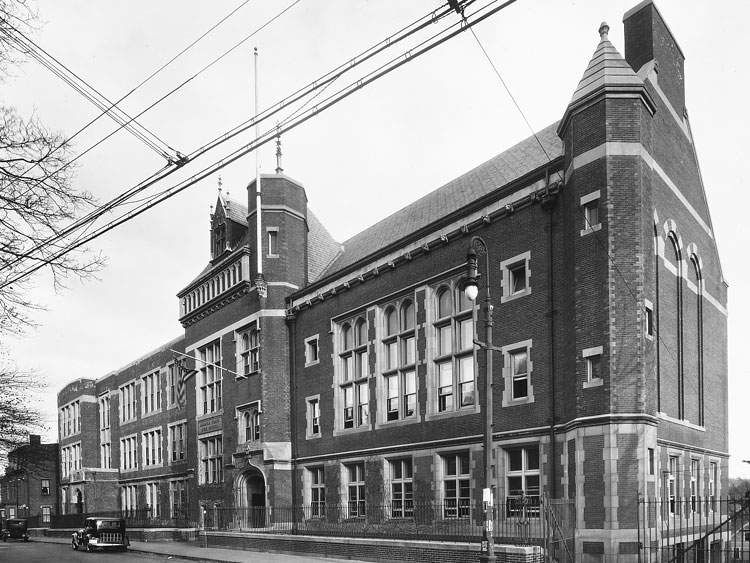
The Jamaica Plain High School at 76 Elm Street was built in 1900. The impressive building is designed in Tudor Revival style. Photograph courtesy of David Rooney.
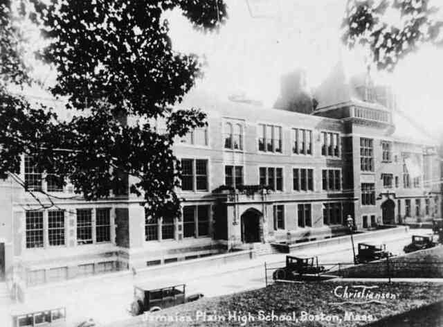
Jamaica Plain High School, 76 Elm St. 1910.
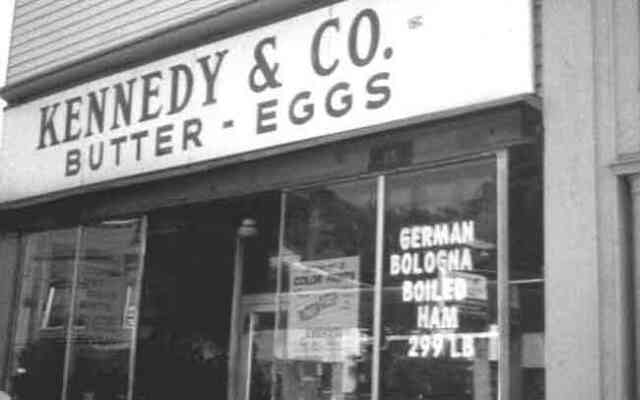
Located near the corner of Seaverns Ave. on Centre St., Kennedy's Butter and Eggs closed at the end of January 2000. The Kennedy's chain once had more than 100 stores across New England.
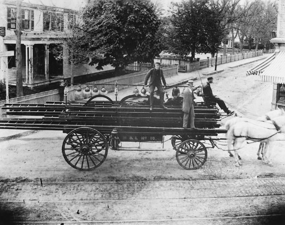
This hook and ladder wagon was photographed in 1885 at the corner of Centre and Burroughs Streets. The Seaverns House is visible to the left.
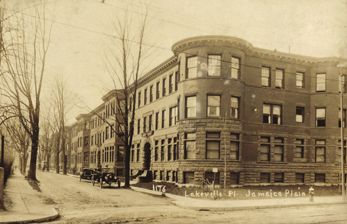
1176 Lakeville Place
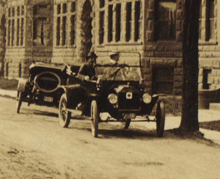
Lakeville Place at Centre Street (close-up)
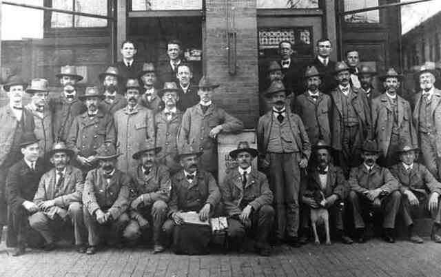
U.S. Postal Service employees pose outside the post office bulding in Woolsey Square near the current location of the Green St. Orange Line station.
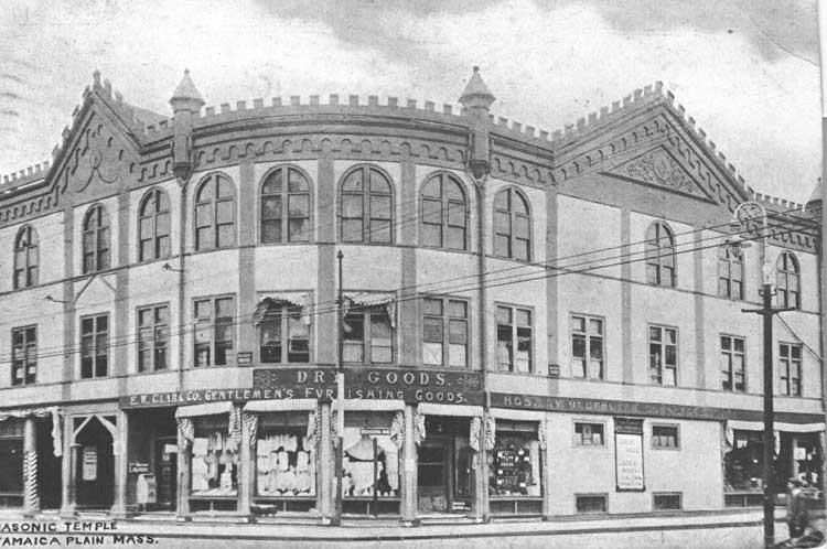
In this photograph taken at Seaverns and Centre, the Masonic Temple occupies the second floor.
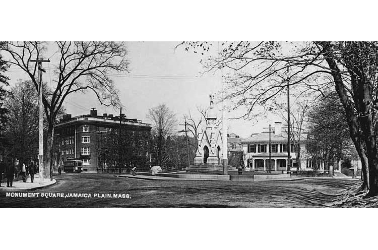
View of Monument square about 1905.
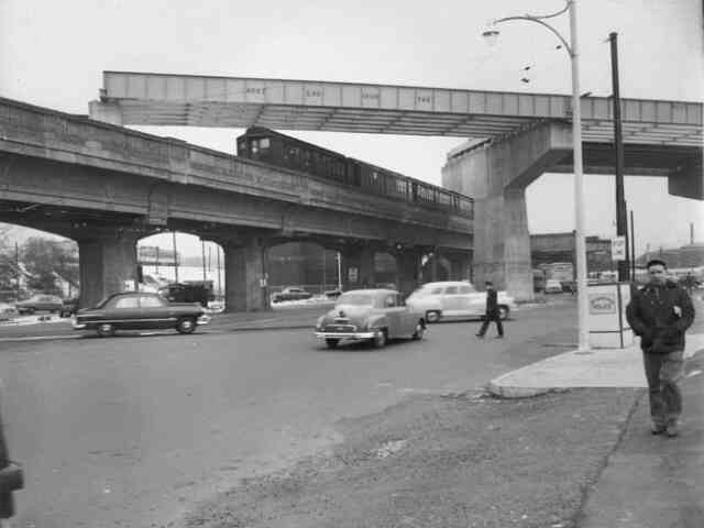
As a train travels towards downtown Boston along the Boston Elevated Railway at Forest Hills, a portion of the new Monsignor William J. Casey Overpass (Morton St.) is being constructed above.
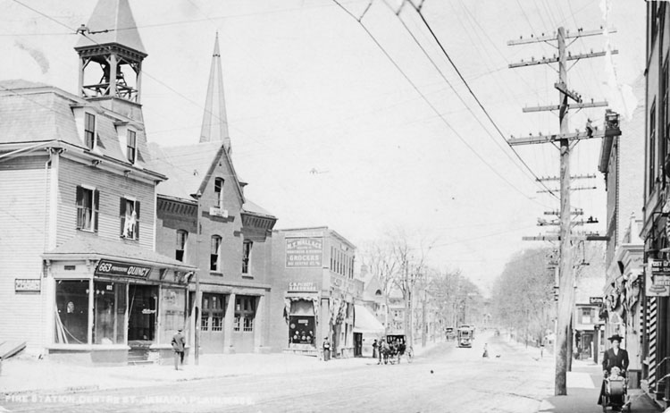
This 1885 photograph shows Centre Street between Thomas and Green Streets. Photograph courtesy of the Boston Public Library.
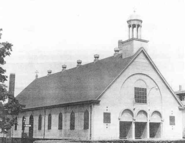
Our Lady of Lourdes Hall
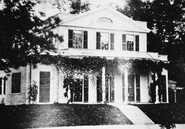
First Pinebank House
Pinebank I was built in 1802 for James Perkins (1761-1822) who was a China trade merchant. It was constructed as a summer country house on the banks of Jamaica Pond.
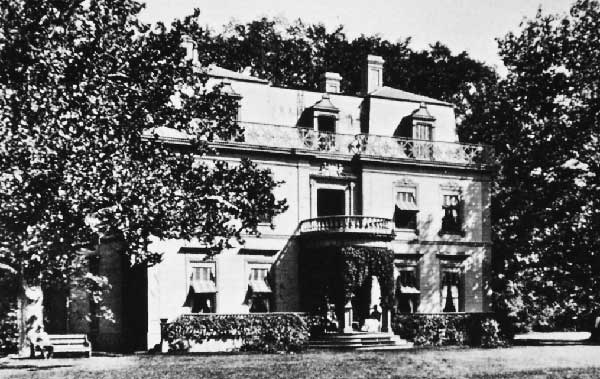
Second Pinebank House
Pinebank II was built in 1848 (on the same site as the original house) for Edward Newton Perkins as a year-round residence. It was one of the earliest French Second Empire houses in the Boston area and the architect was Jean Lemoulnier. Photograph courtesy of Anthony Mitchell Sammarco
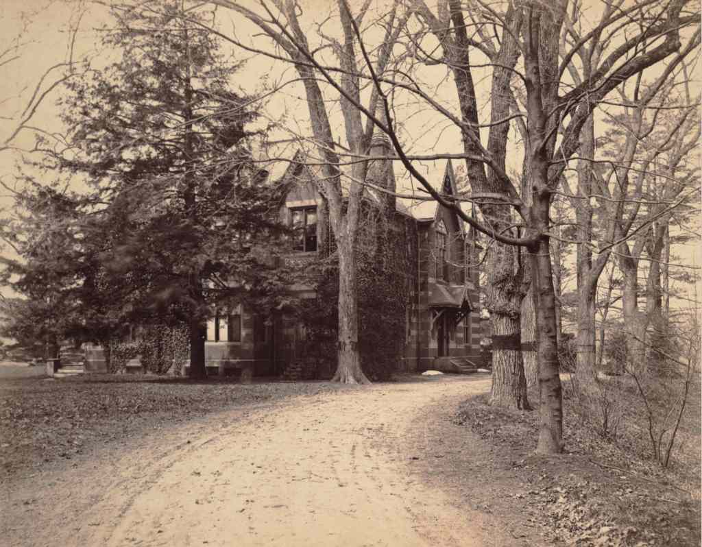
Third Pinebank House
Pinebank III was built when Pinebank II burned in 1868. The third house was designed by Sturgis & Brigham in the Victorian Gothic style out of red brick with imported English terracotta ornamentation.
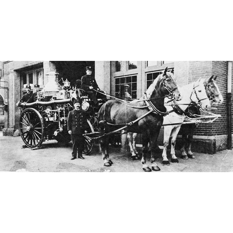
Firemen outside of Engine Company 28 on Centre Street, near Myrtle Street in 1904. Photograph courtesy of the Boston Public Library.
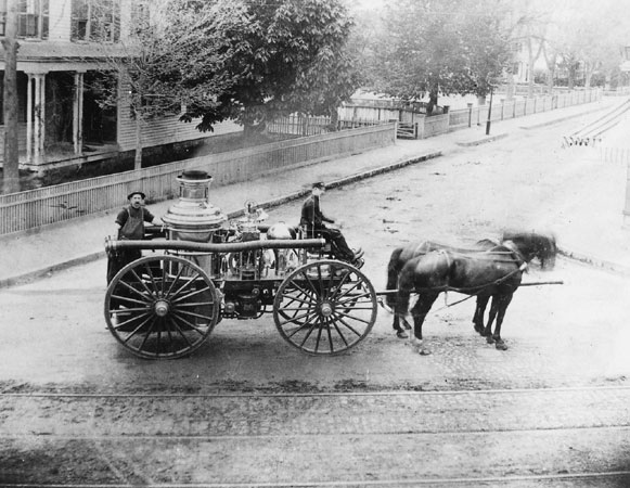
Two firemen pose with a horse-drawn chemical fire engine in this 1880 photograph taken at Centre and Burroughs Streets. These engines used chemicals rather than water to fight fires.
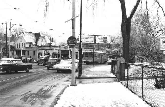
A view of Centre St. looking north towards Eliot St. in 1965. Courtesy of Frank Norton.
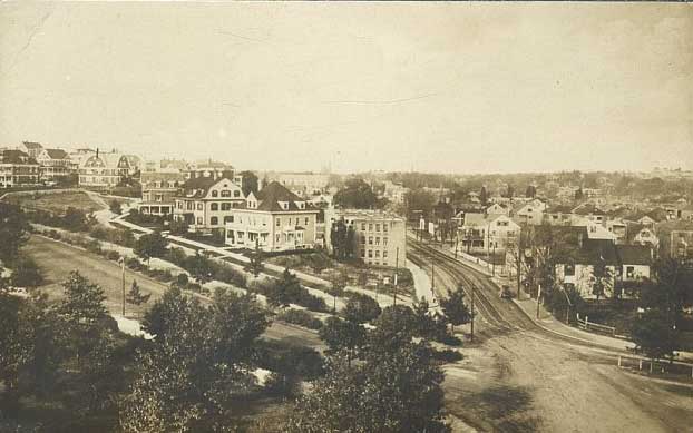
This view at Forest Hills looks north on South Street while Morton Street crosses from left to right.
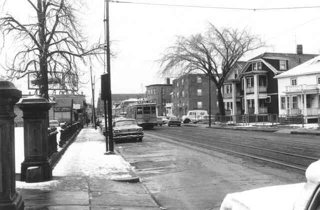
A 1965 view of South St. looking south from Centre St. The entrance to Curtis Hall is seen on the left. Courtesy of Frank Norton.
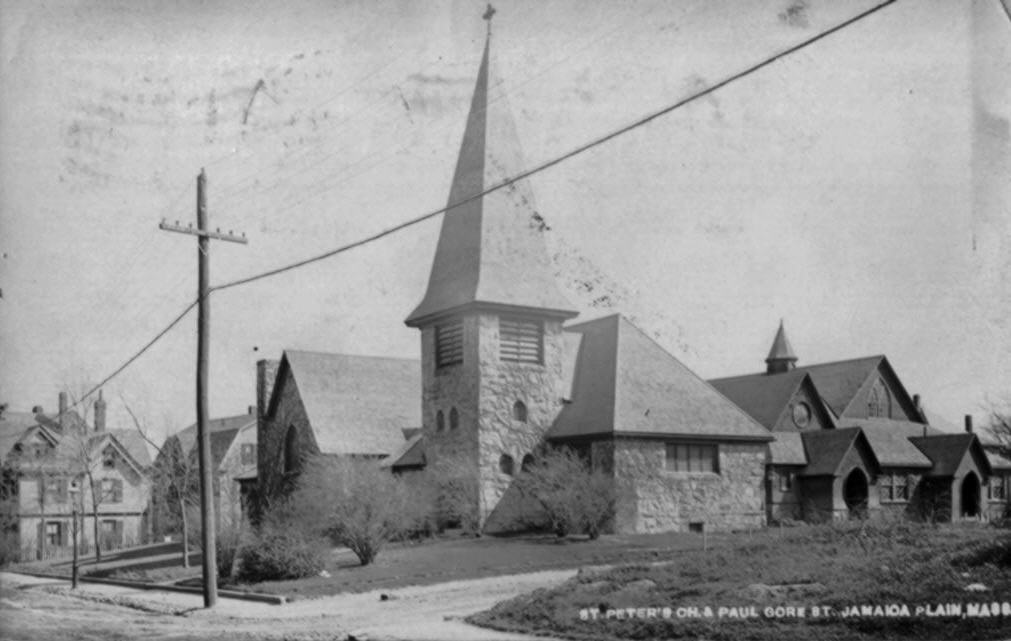
St. Peter’s Church, once located on Paul Gore Street. Taken from a photographic postcard in the historical society archive. Photograph taken circa 1908.
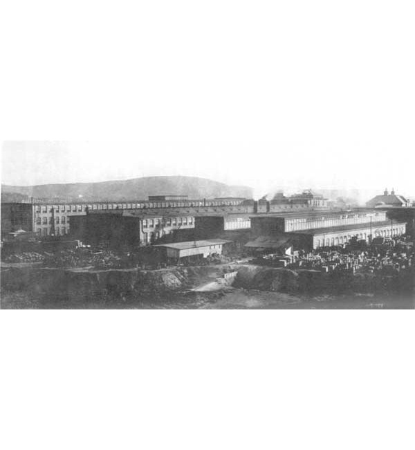
The Sturtevant manufacturing plant.
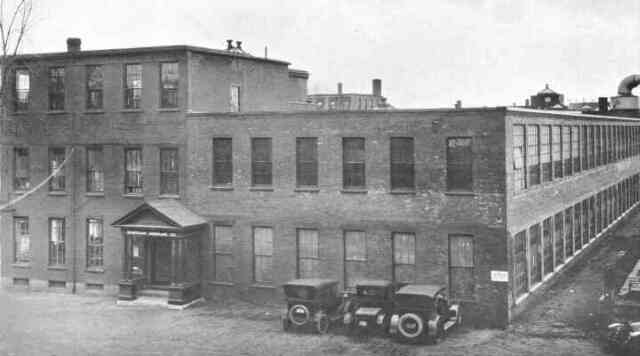
The Sturtevant manufacturing plant on Amory St. between Williams and Green Streets. From the 1919 Aircraft Year Book, Aircraft Manufacturers Association Inc. Courtesy of Vincent Tocco.
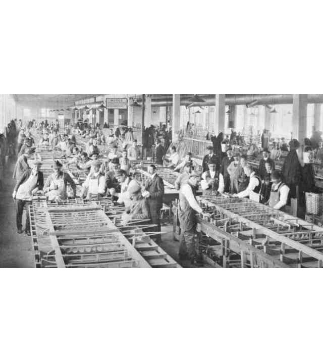
Workers assemble aircraft wings in the Sturtevant manufacturing plant on Amory St. 1919 Aircraft Year Book, Aircraft Manufacturers Association Inc. Courtesy of Vincent Tocco.
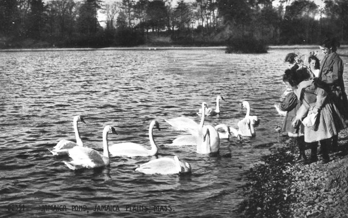
Photograph of children feeding the swans at Jamaica Pond taken from a period postcard (circa 1900). A high resolution version of this photograph can be
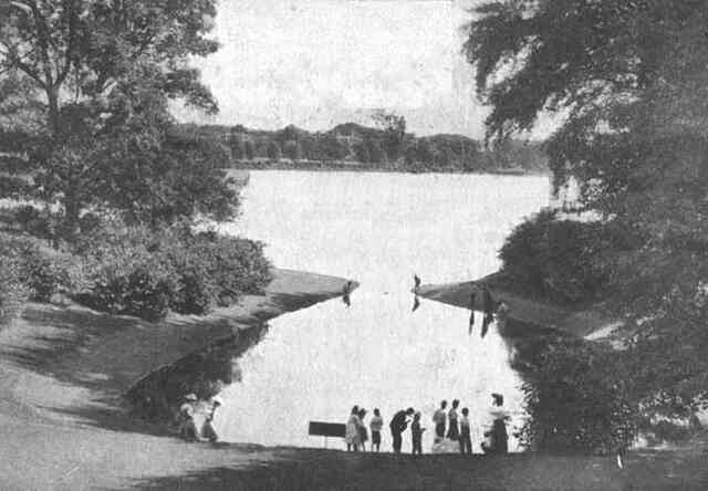
Perkins' Cove was once located on Jamaica Pond below Pinebank. It was filled in before World War I.
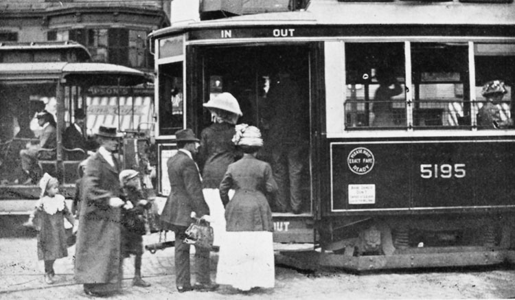
Car 5195, an Arborway subway car, loads passengers on Centre Street ca. 1912.
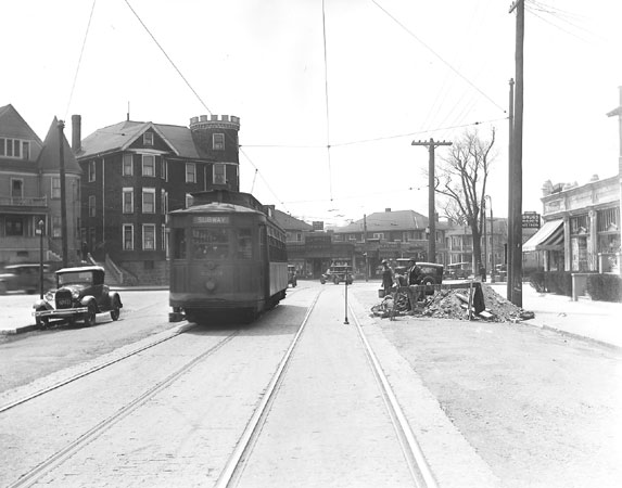
A trolley at Centre and South Huntington Streets.
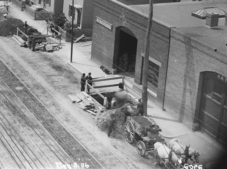
Looking southwest in 1906 down Washington Street from Green Street. Excavations are under way for the construction of the elevated railway (the old Orange line) that will run down Washington Street. This is an enlargement of a portion of another image that also appears in this collection. The elevated tracks were torn down in 1987 and replaced with the new Orange Line subway. Photograph courtesy of David Rooney.
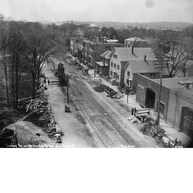
Looking southwest in 1906 down Washington Street from Green Street. Excavations are underway for the construction of the elevated railway (the old Orange line) that will run down Washington Street. An enlargement from this image also appears on this page. The elevated tracks were torn down in 1987 and replaced with the new Orange Line subway. These buildings are extant at 3371 Washington Street. You can see the ghosts of the original doors on the current buildings. Photograph courtesy of David Rooney.
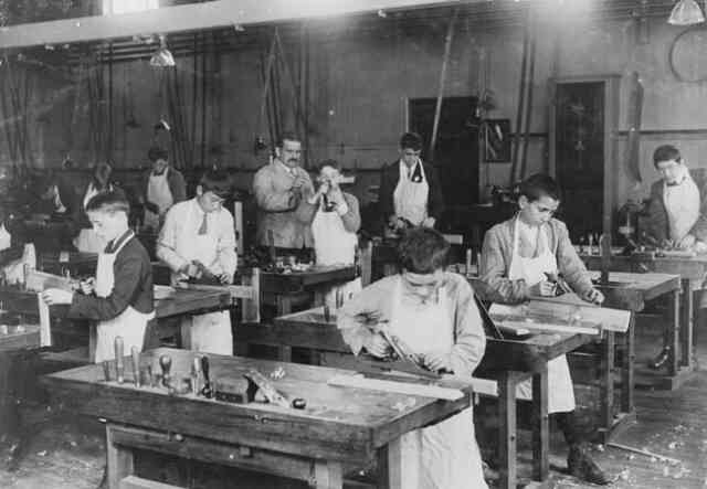
Boys mastering woodworking skills, 1919. Photograph by Lewis W. Hine. Courtesy of the Library of Congress.
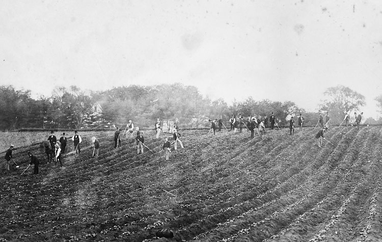
Guests help with hoeing on the Curtis farm.
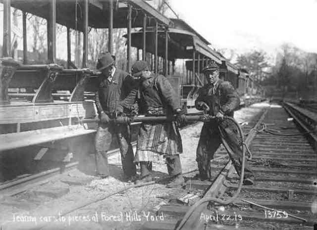
Workmen using a pneumatic impact wrench dismantle open air trolley cars at the Forest Hills yard in 1919. Courtesy of Anthony Sammarco.
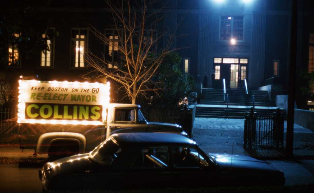
This view is outside the Mary E. Curley school in November of 1963. Photograph courtesy of Paul Gill.
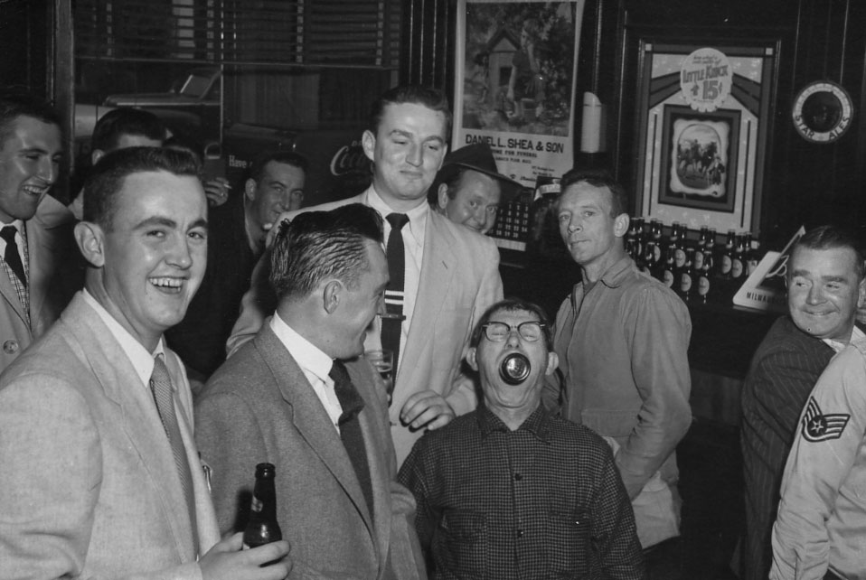
This group of gentlemen are enjoying a beer or two at Kilgariff’s Tavern at 131 Green Street. Date is unknown. Photograph courtesy of Cathy Andrews.
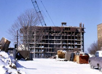
Construction begins on the Jamaicaway Towers in 1965. Photograph courtesy of Paul Gill.
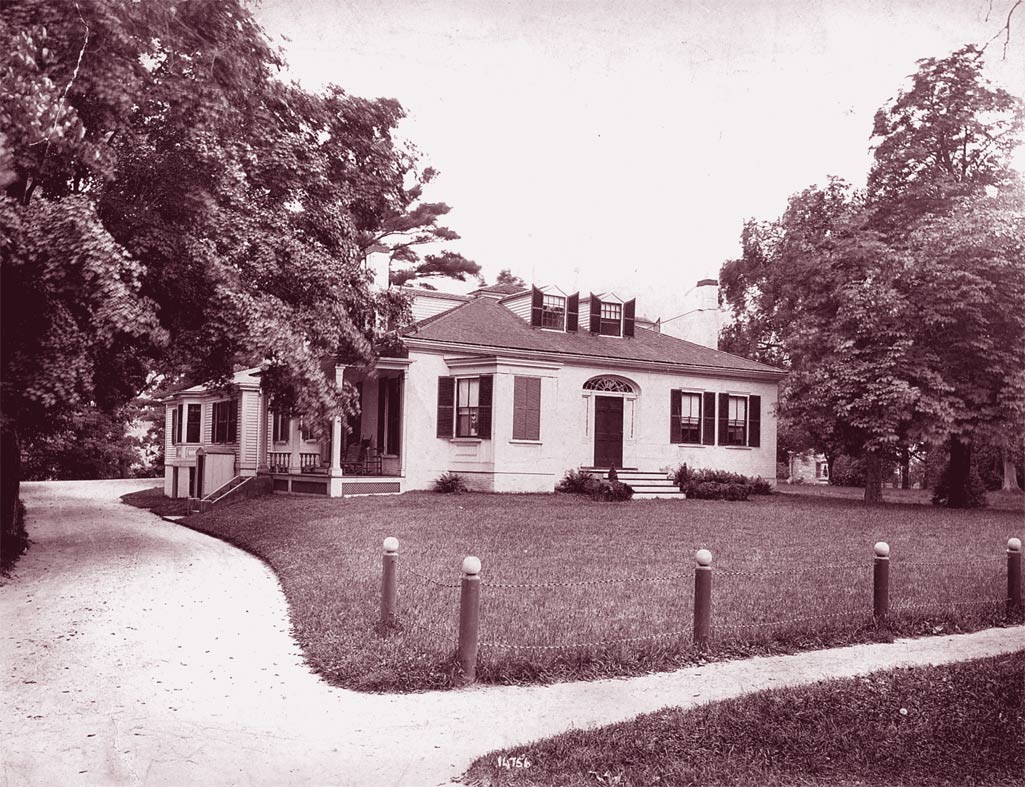
The Weld House on South Street. No longer standing.
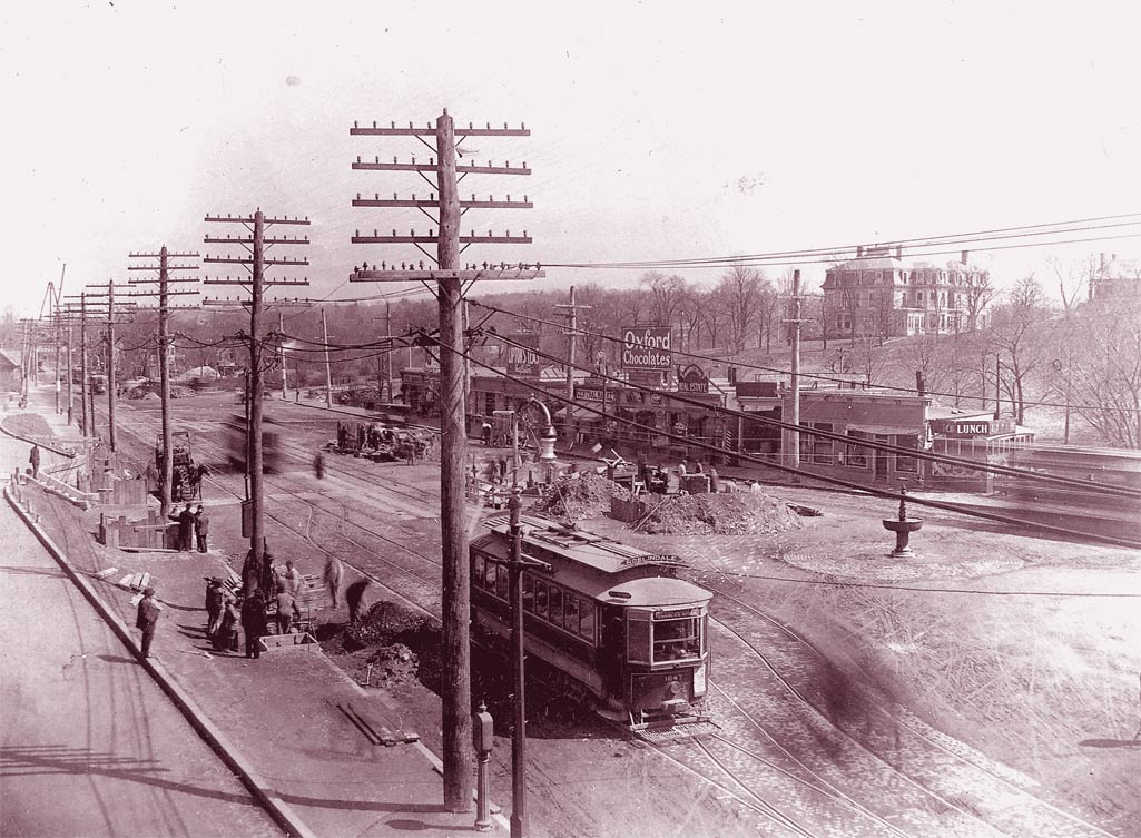
The birth of development across from what is now Forest Hills Station on Washington Street. In this small strip of stores can be seen a lunch counter, a chocolate shop, and other small businesses. Download photo.
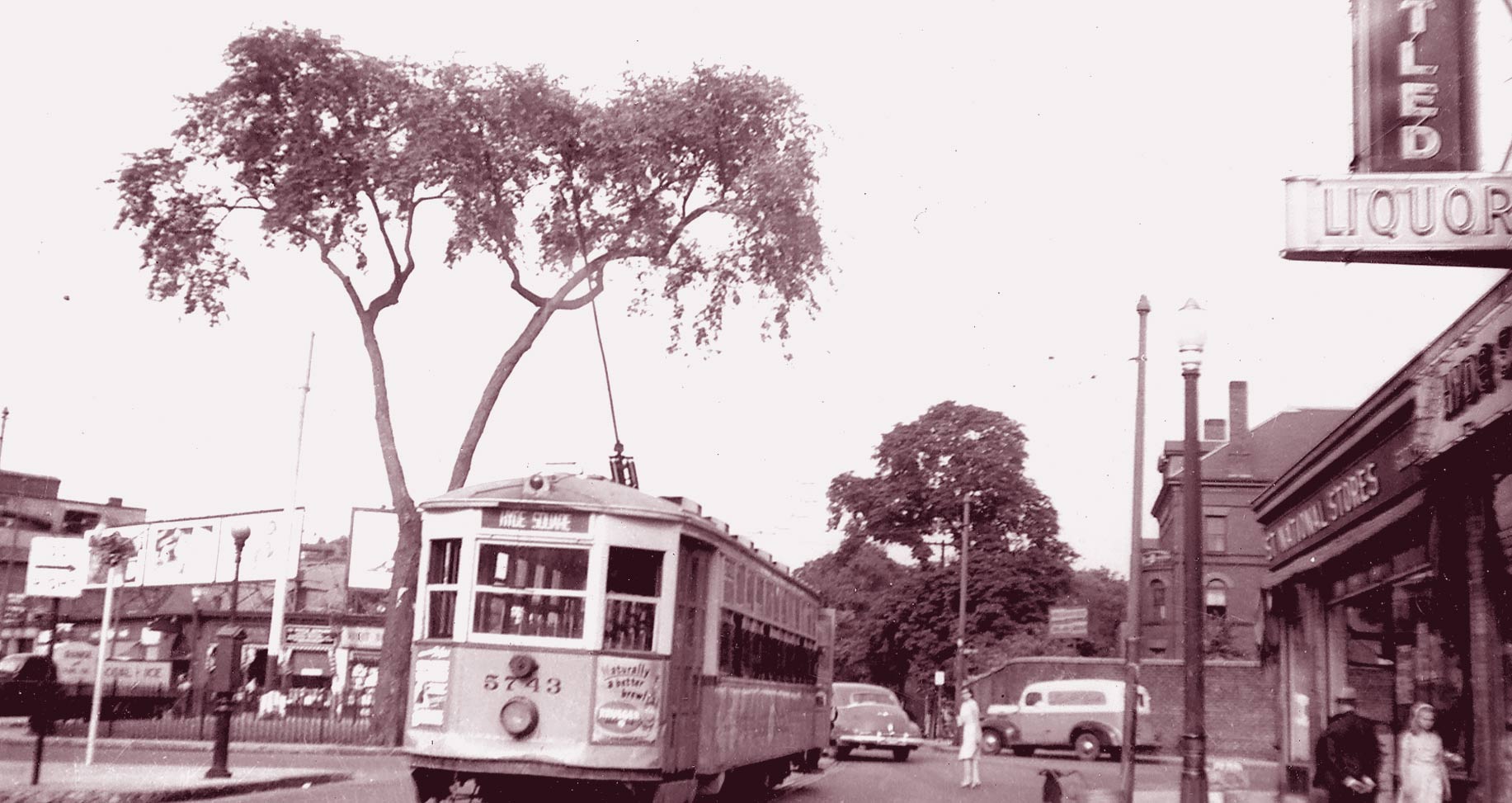
A trolley heads down Centre Street towards Jackson Square in this view of Hyde Square circa 1940. Download photo.
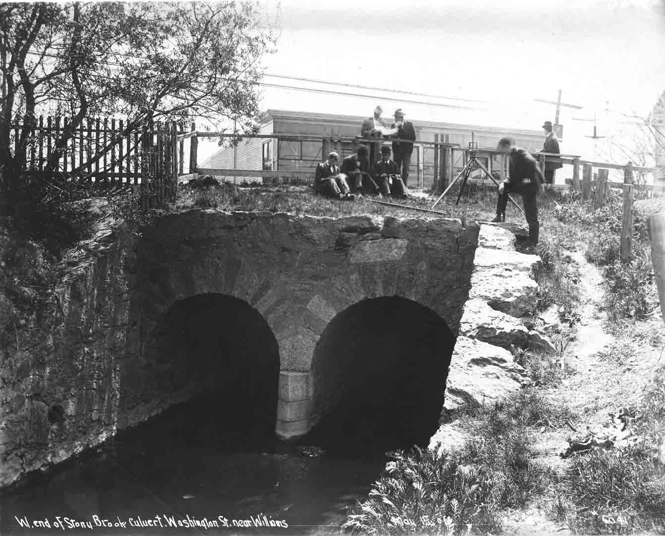
A view of the Stony Brook culvert near Washington and Williams Streets.
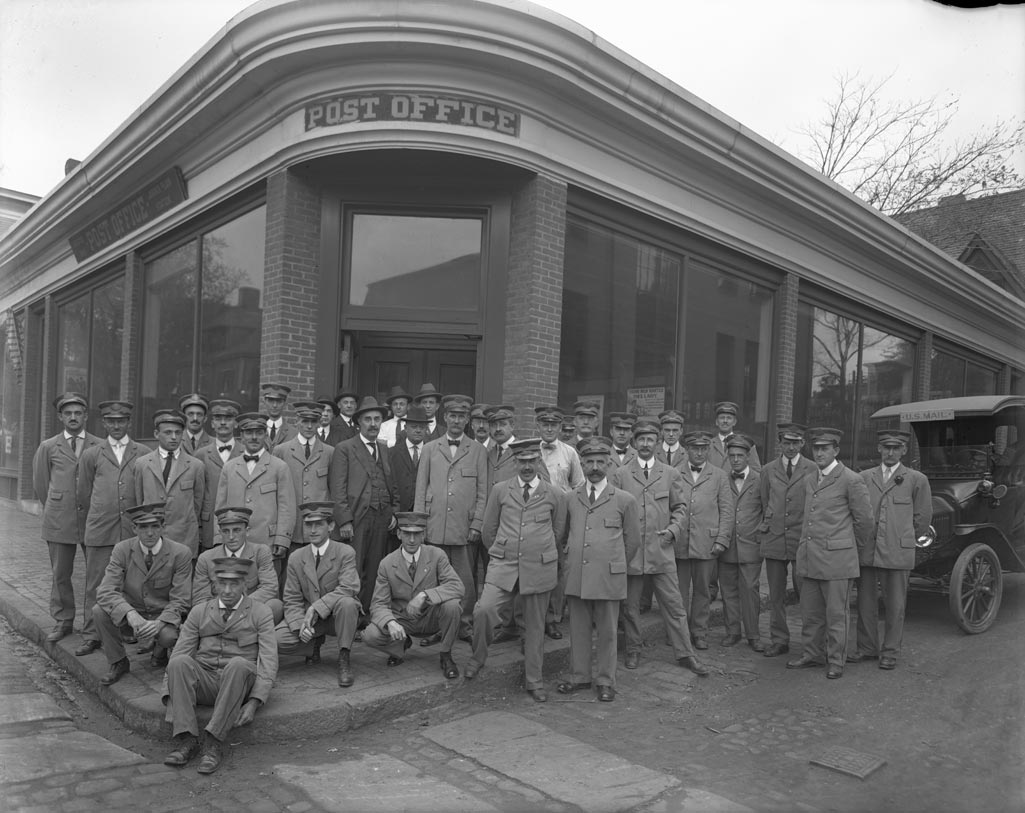
U.S. Post Office staff pose in front of the post office at the corner of Cheshire and Green Sts. Courtesy of Boston Public Library.
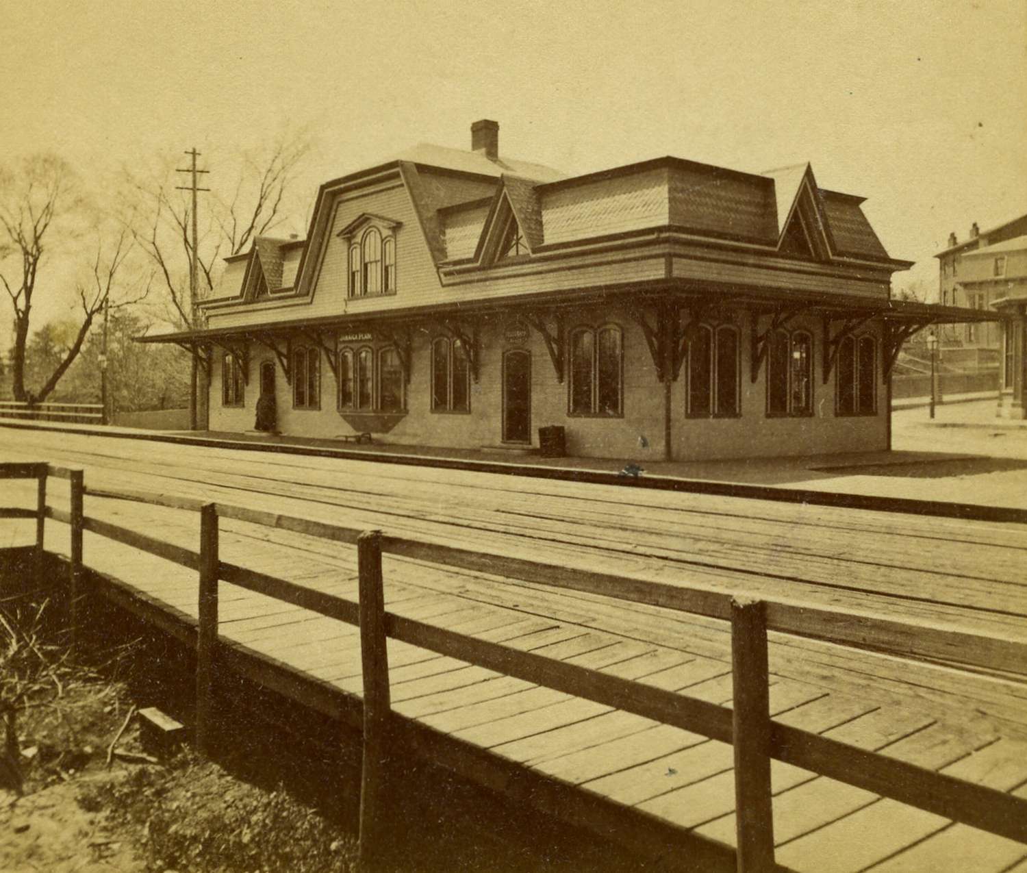
An image of the Jamaica Plain Station before the Boston & Providence Railroad embankment was constructed. Gordon Street can be seen to the right rear of the station. The new incarnation of this stop is Green Street MBTA station on the Orange Line. Courtesy of Greg French.
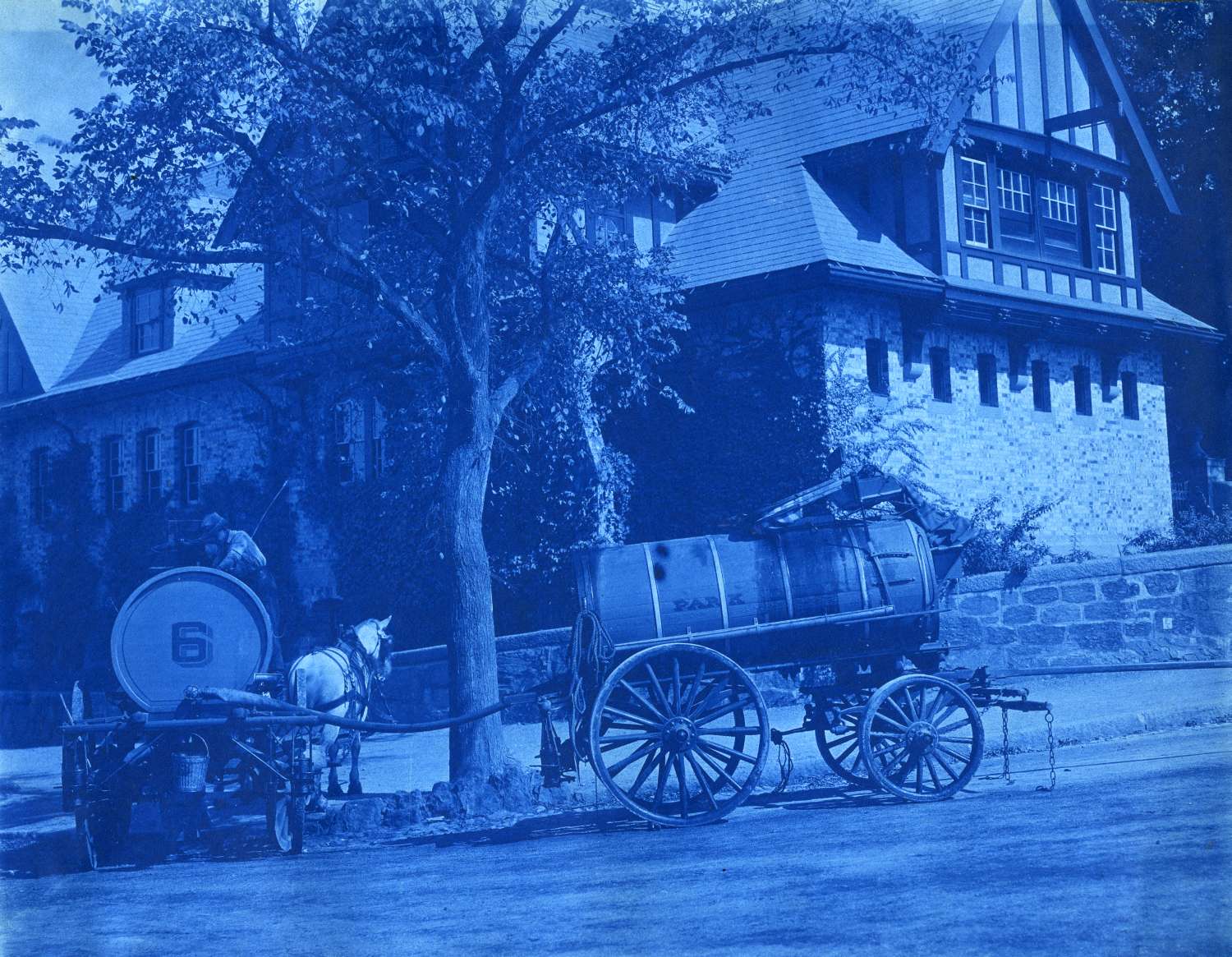
A cyanotype showing two horse-drawn oil sprinkler carts at the corner of the Jamaicaway and Perkins Sts. September 26, 1906. Courtesy Greg French.
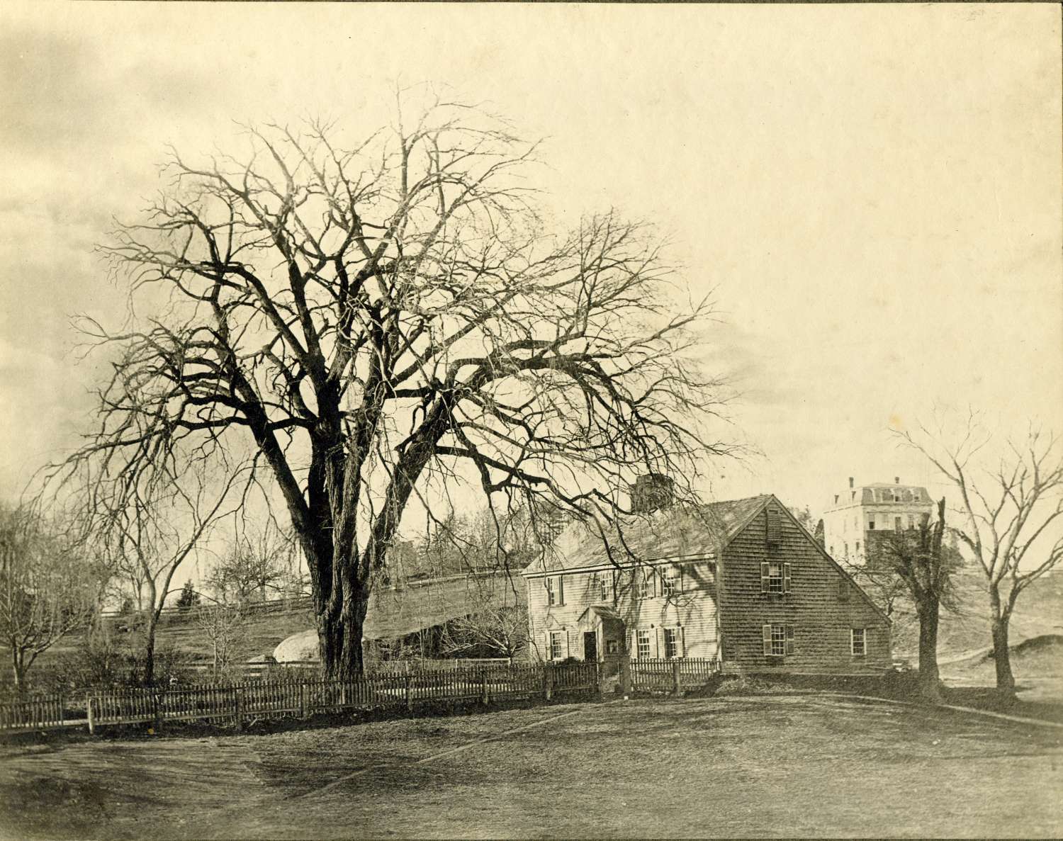
The first significant dwelling in Jamaica Plain, the homestead of William and Sally Curtis who arrived in 1638. Courtesy of Greg French.
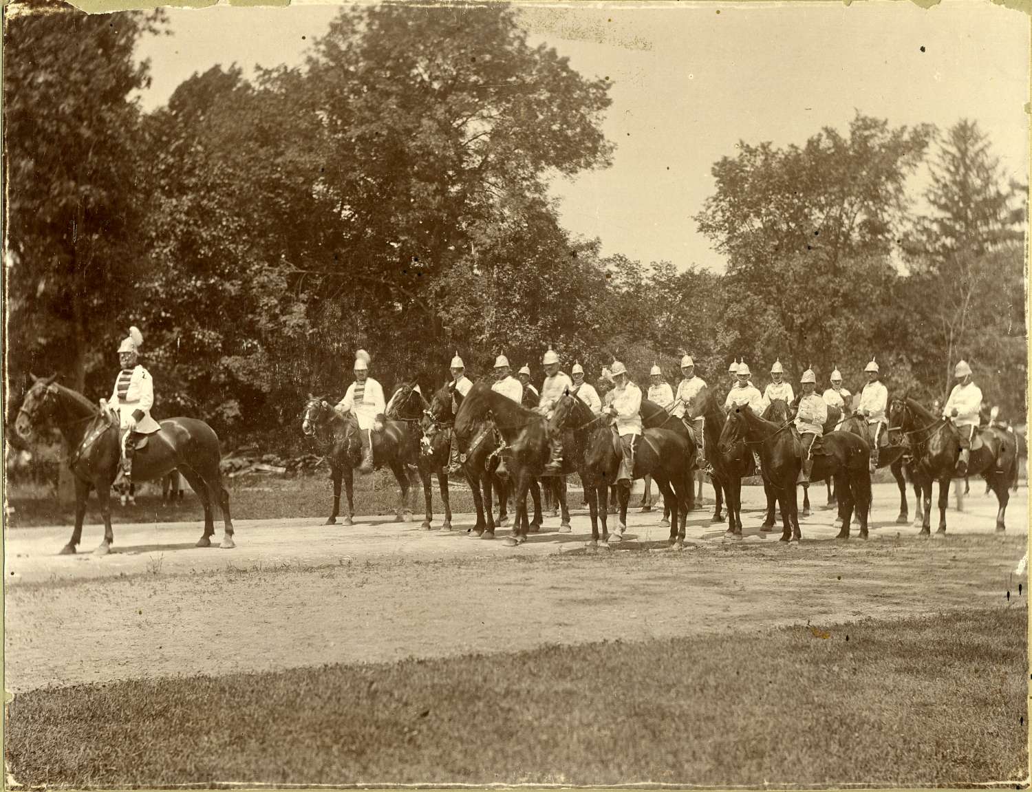
Members of a fraternal organization parade through the Arnold Arboretum on horseback. July 4, 1898. Courtesy of Greg French.
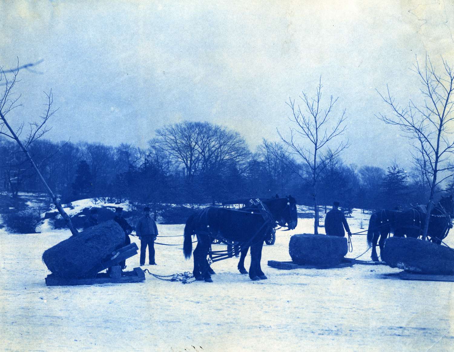
A cyanotype shows draft horses being used to transport trees by sled for planting. Possibly Franklin Park or Arnold Arboretum. Courtesy of Greg French.
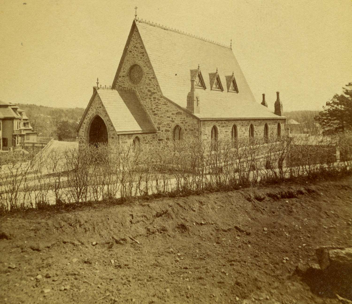
The former Methodist Church at the corner of Elm and Newbern Street. Courtesy of Greg French.
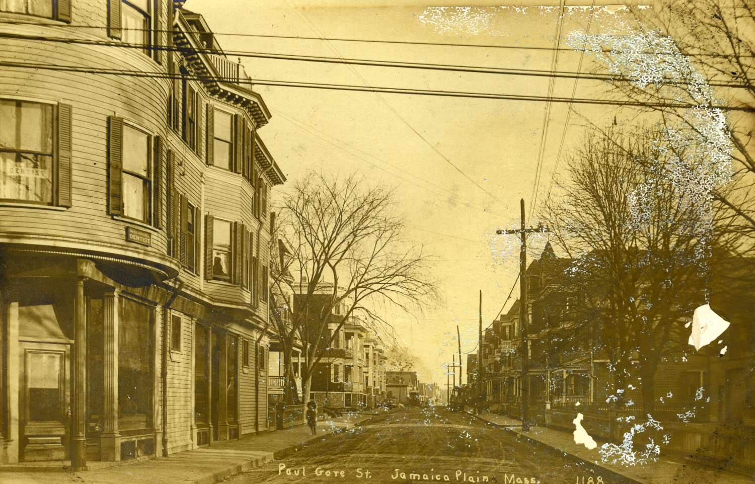
Paul Gore Street as seen from the corner of Centre Street. Courtesy of Greg French.
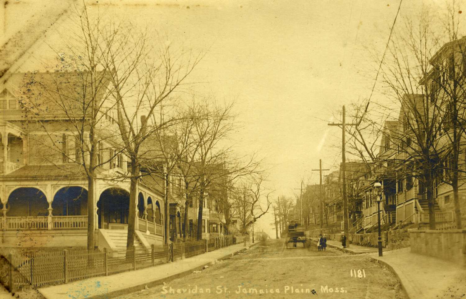
Sheridan Street as viewed from Centre Street. Note the horse drawn wagon, children and gas lights. Courtesy of Greg French.
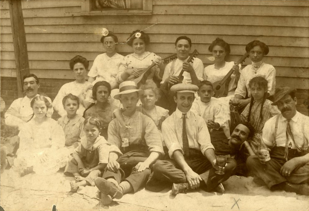
The small Roessle Brewery was operated by John Roessle and stood at 1250 Columbus Avenue. Active from 1846 to 1918 and from 1933 to 1951. This photograph is circa 1905. Courtesy of Greg French.
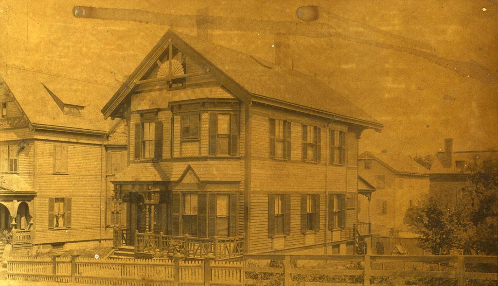
16 Sheridan Street was built for and Inspected by Michael W. Fitzsimmons and his wife Sarah. Fitzsimmons was the keeper of the plans for the Boston Building Department. The photograph was taken by the Holmes Brothers of Needham, Mass about 1886. Photograph provided courtesy of Michele Clark.
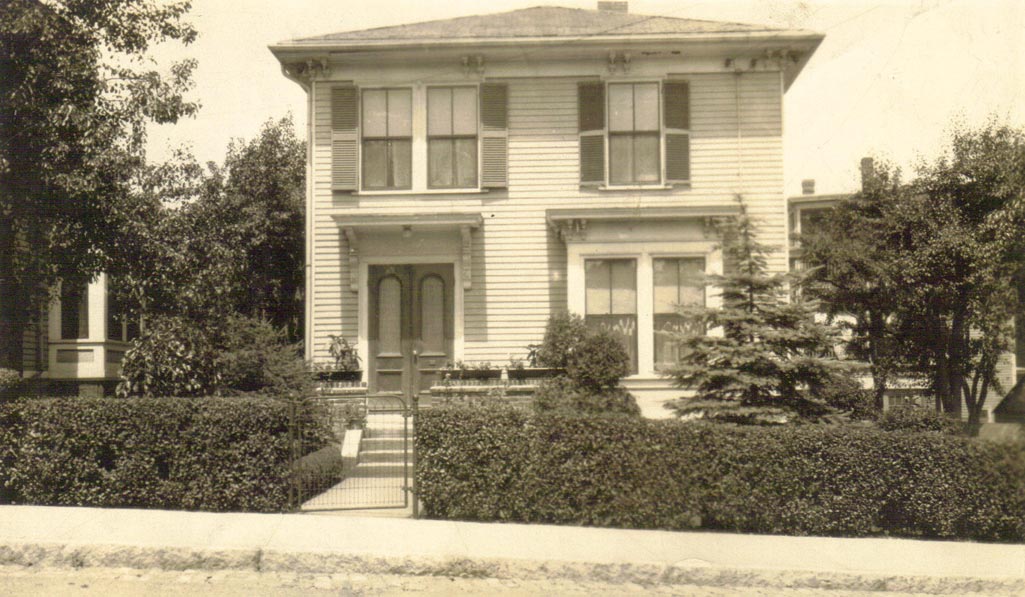
Show here is 11 Evergreen Street in Jamaica Plain. Photograph taken between 1931 and 1933. This was the home of Charles and Josephine Dunlap from 1930 to 1937 and has been provided courtesy of their son, Jim Dunlap.
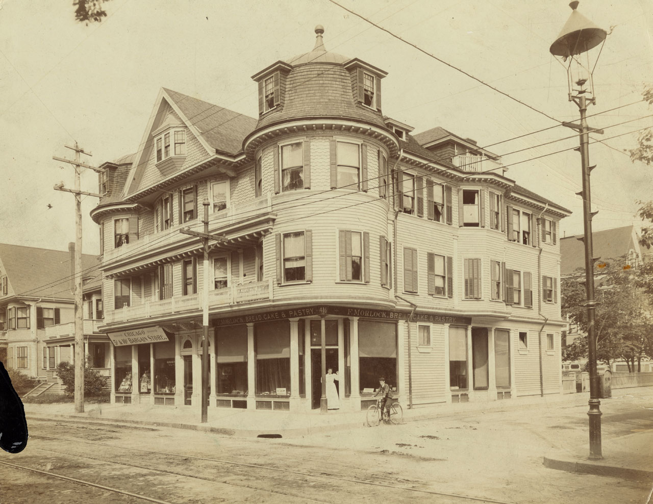
Frederick Morlock (1850-1906), born in Germany and naturalized in 1881, owned the large building at 416 Centre Street and the smaller house next to it at 408 Centre Street. He owned and operated the bakery in the corner store pictured here where El Oriental de Cuba is currently located. The photograph was taken around 1905. The woman in the doorway is believed to be Margaretha (Gretchen) Maylandt Morlock (1877-1914). Photograph provided courtesy of Kathy Griffin.
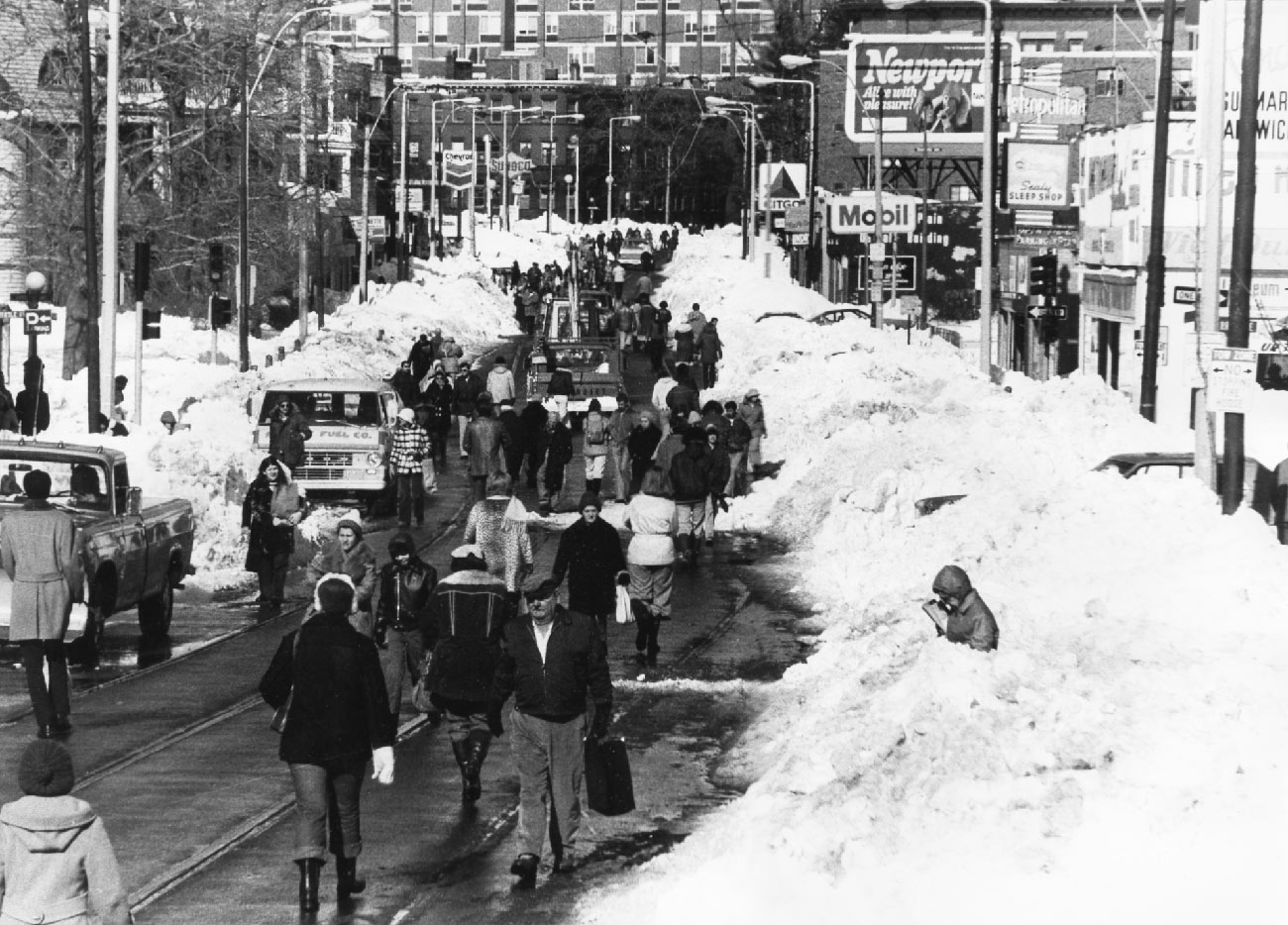
Jamaica Plain residents begin to venture out of their homes after a single lane of traffic is cleared of snow in February, 1978. This view is from Green Steet looking towards Boston. Photograph taken by and provided courtesy of Mark Hoffman.
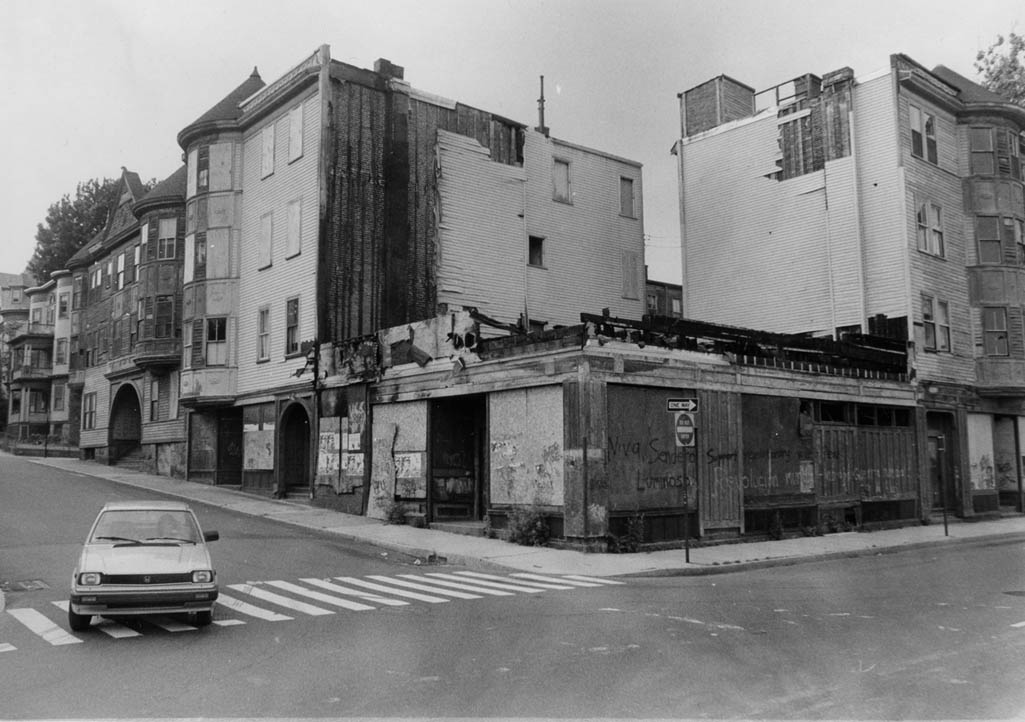
This row of buildings at Paul Gore and Lamartine Streets was known as Jacob’s Block. The corner building was a pharmacy with a soda stand. The pharmacists were Mr. Wholley and Charlie Tuite. A bar stood on the corner across from the pharmacy and featured entertainers on Saturday nights. This property later became the center of a battle waged between the landlord George Carroll and a group of residents supported by community activists and organizations. Photograph taken by and provided courtesy of Mark Hoffman.
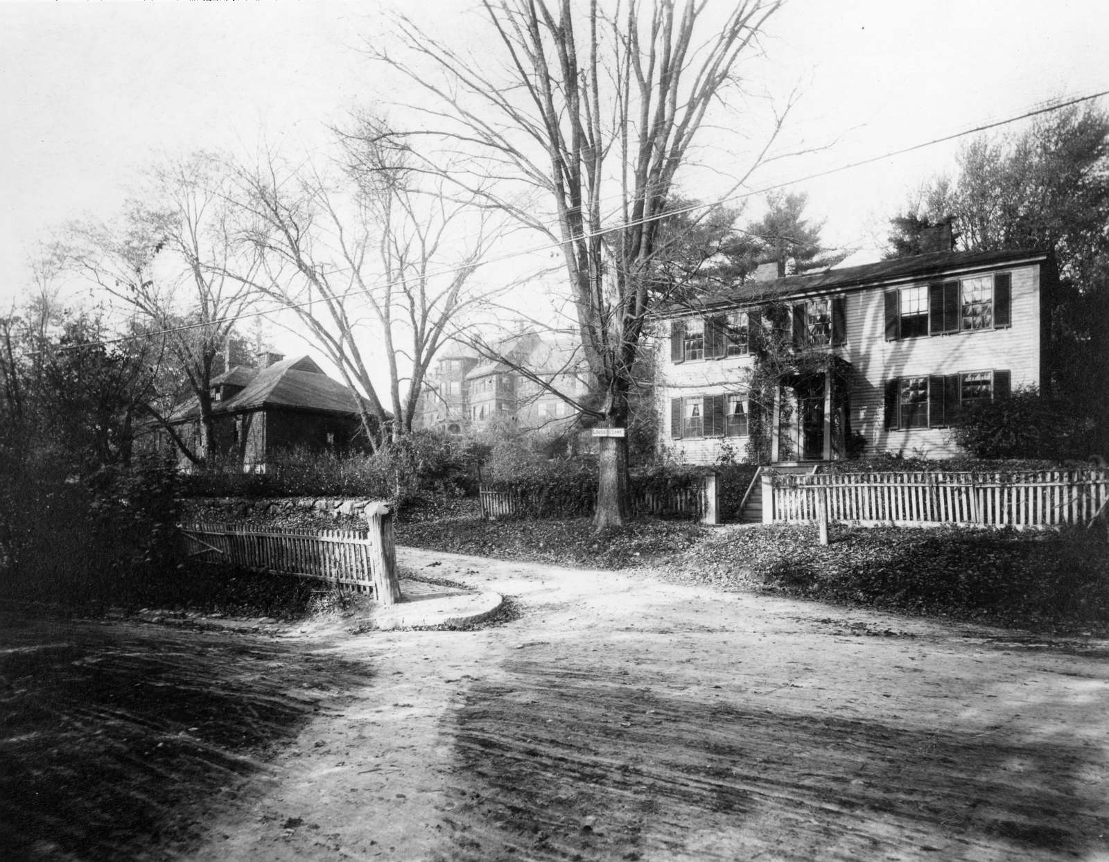
1101 Centre Street at the corner with Louders Lane.
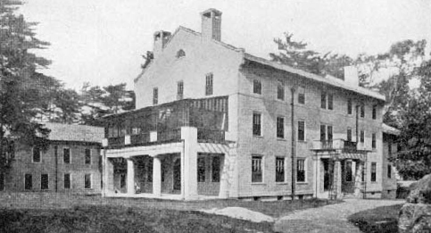
Boston Talitha Cumi Maternity Hospital operated at 215 Forest Hills Street by the New England Moral Reform Society. Representing an extreme wing of the American Protestant movement known as the Second Great Awakening, members of the Moral Reform Society believed in social action as a moral imperative and, in particular, conducted a vigorous crusade against the double standards of a male-dominated society.
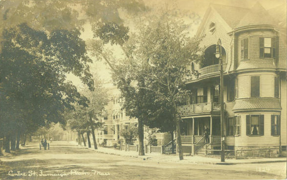
Centre and Hollbrook Streets.
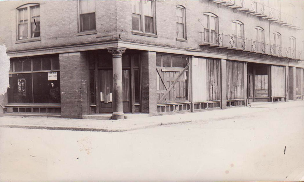
An early Jamaica Plain library, known as a deposit station since books were placed there on deposit for the public to borrow, is shown in this undated photograph. The branch opened at the corner of Lamartine and Paul Gore Streets in 1897. Photograph and caption information courtesy of Jane Bickford, Boston Public Library, Connolly Branch.
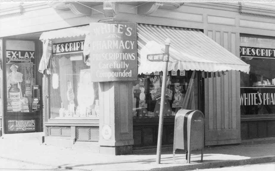
White’s Pharmacy on Paul Gore Street. Courtesy of Jane Bickford, Boston Public Library, Connolly Branch.
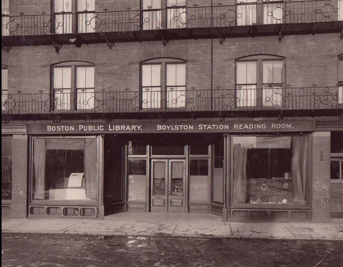
Boston Public Library Boylston Station Reading Room opened in 1905 on the ground floor of the railroad station. The reading room was enhanced in 1927 and became known as the Boylston Branch. In 1935 the current Connolly Branch Library on Centre Steet was opened.
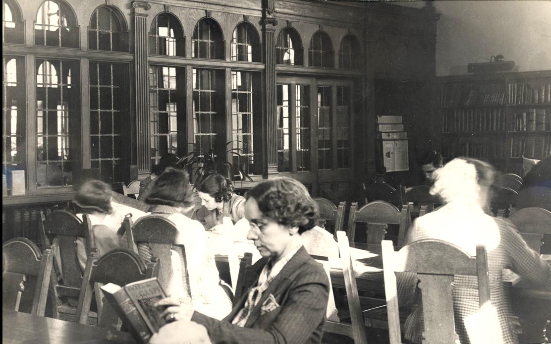
Boston Public Library Connolly Branch Reading Room, ca. 1935
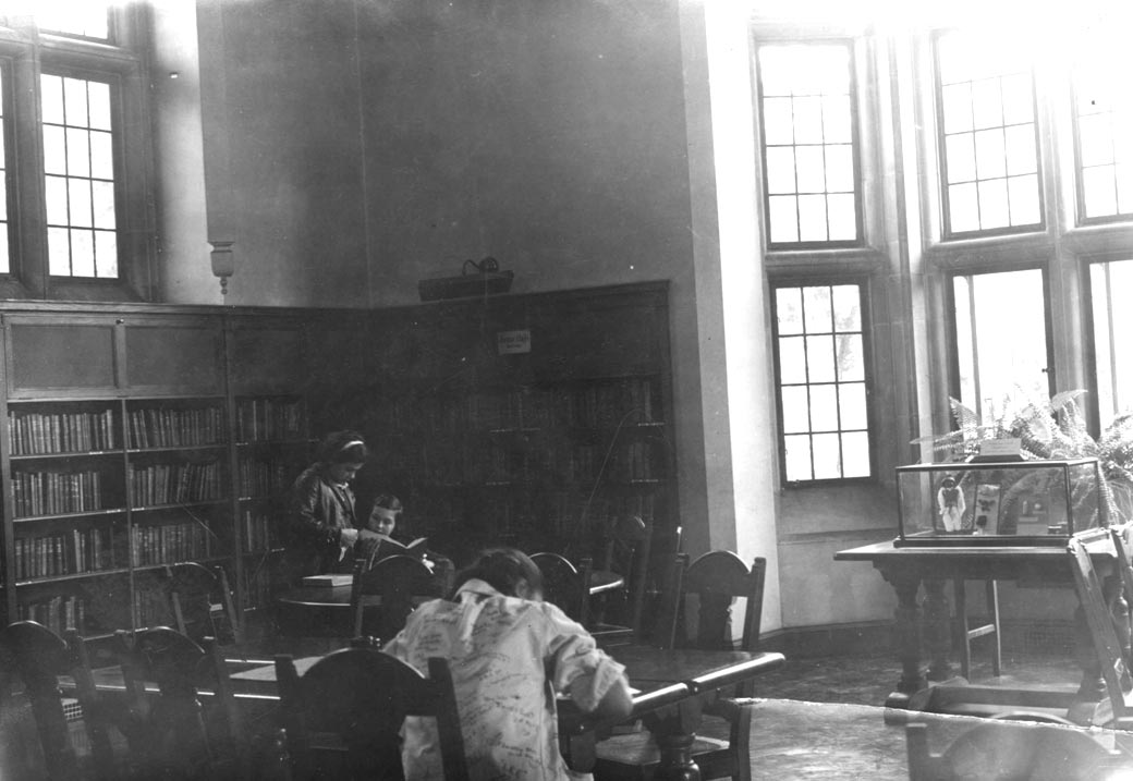
Boston Public Library Connolly Branch Reading Room, ca. 1935
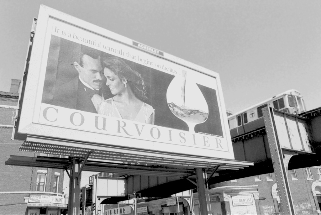
A view just outside of Egleston Square Station, at the corner of Washington and School Streets. Photograph courtesy of Chris Lovett, Neighborhood Network News. circa 1987.
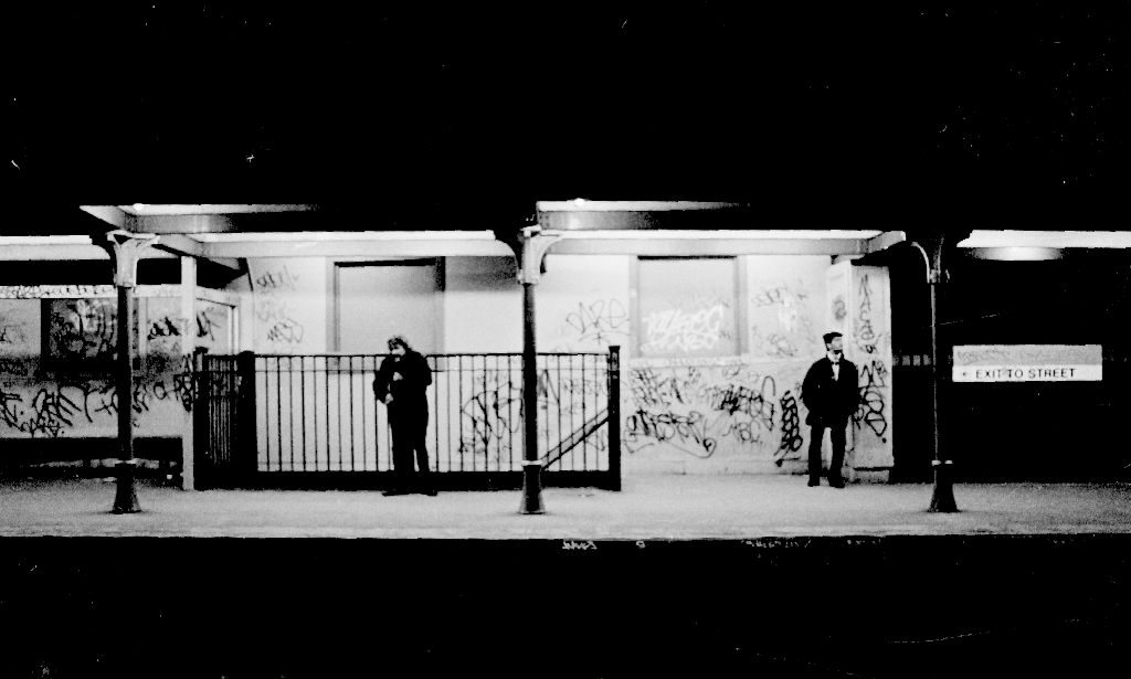
Green Street Station. “Waiting for the last train”. April, 1987. Photograph courtesy of Chris Lovett, Neighborhood Network News. circa 1987.
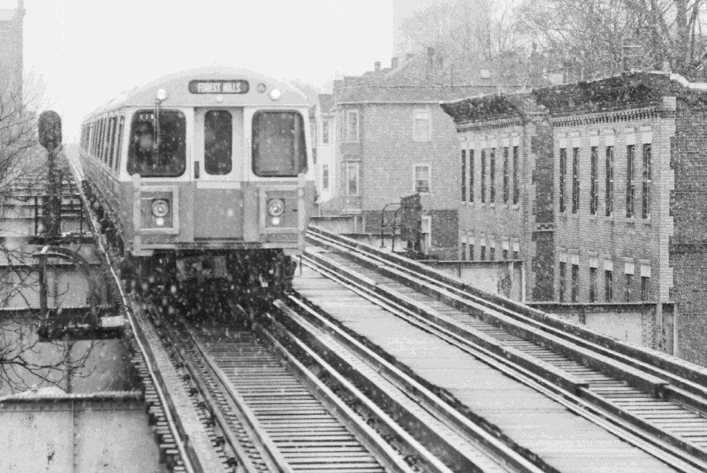
An Orange line trains travels down Washington Street in Jamaica Plain, March 1987. Photograph courtesy of Chris Lovett, Neighborhood Network News.
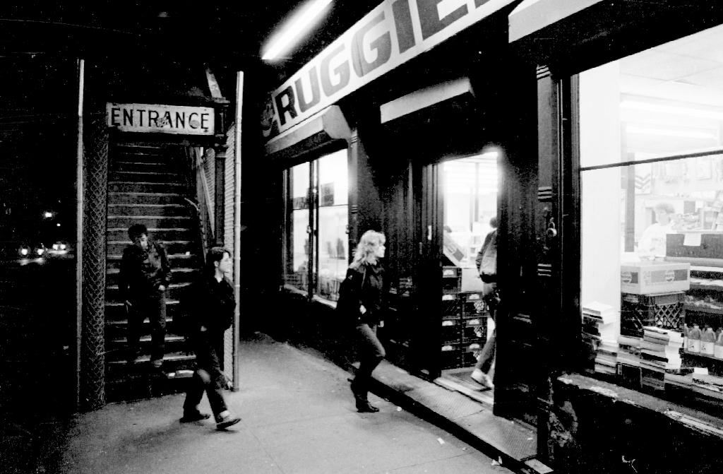
Green Street Station. April 1987. Photograph courtesy of Chris Lovett, Neighborhood Network News.
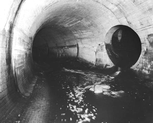
A portion of the system of tunnels that carry the Stony Brook from its origin in the Stonybrook Reservation in West Roxbury to the point where it empties into the Charles River. This undated photograph was taken under Amory Street in Jamaica Plain and is provided courtesy of the Boston Water and Sewer Commission.
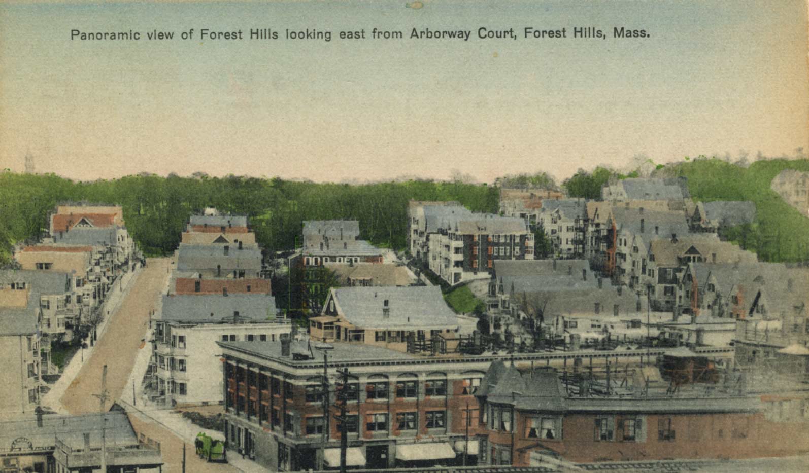
View of Forest Hills. Scanned from a postcard donated by Annie Finnegan, November 2007.
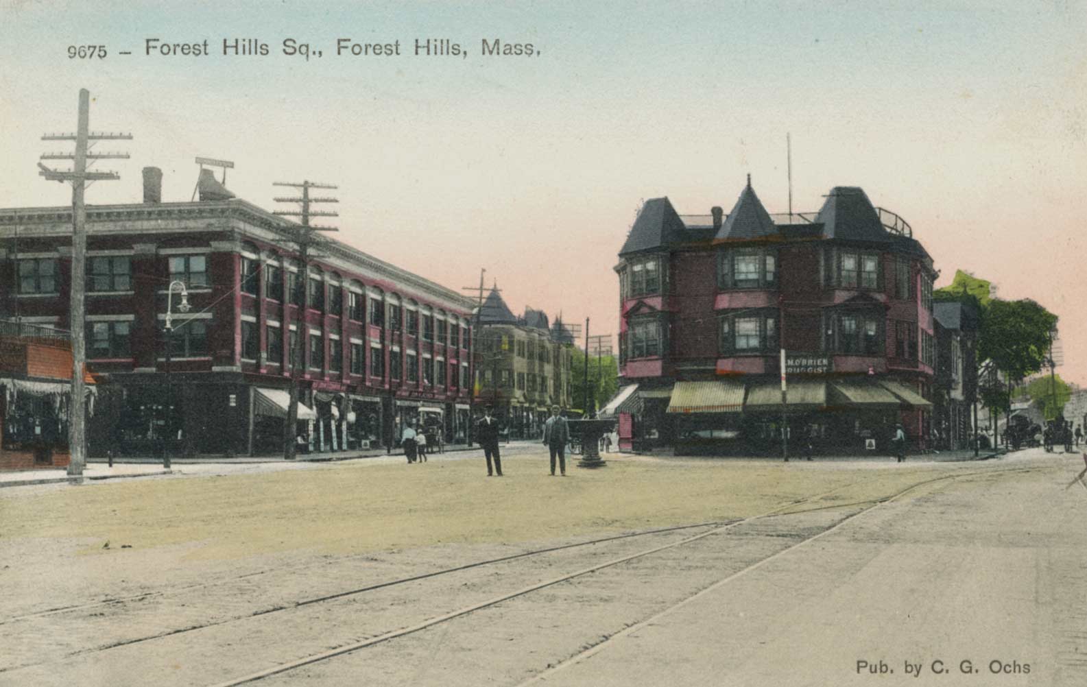
View of Forest Hills. Scanned from a postcard donated by Annie Finnegan, November 2007.
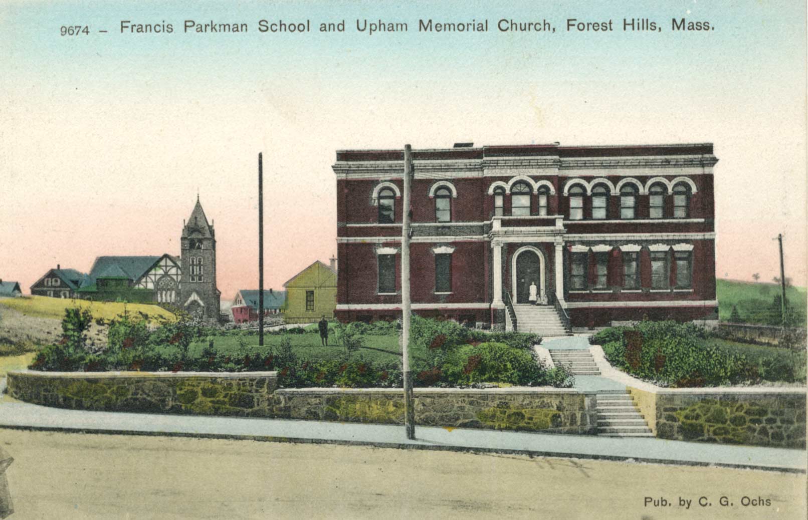
The Parkman School with Upham Memorial Church in the background. Scanned from a postcard donated by Annie Finnegan, November 2007.
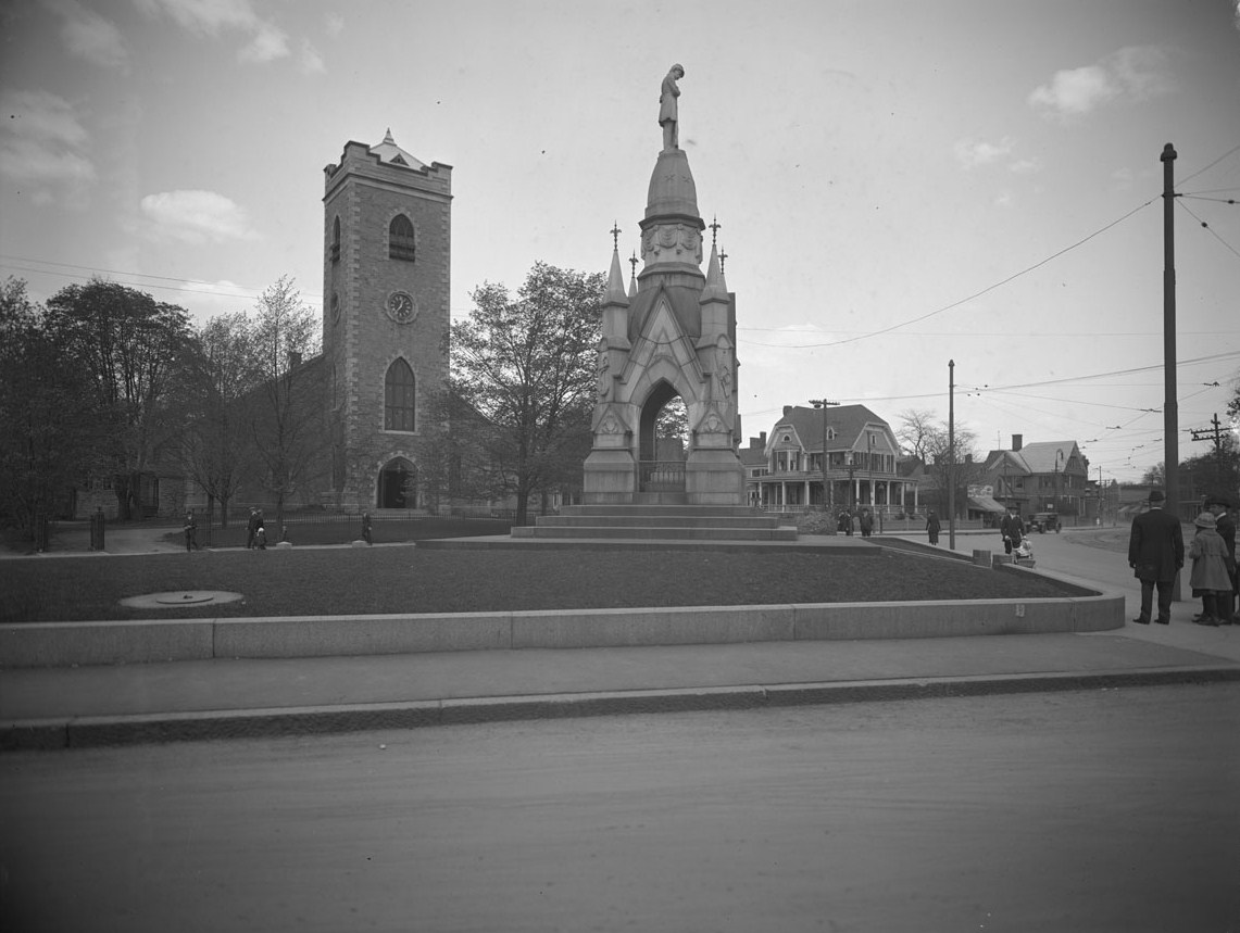
Soldier’s monument and First Congregational Church Society, Eliot Street and South Street. Courtesy of the Boston Public Library per this license. May 1920. Accession No.: 08_01_000783
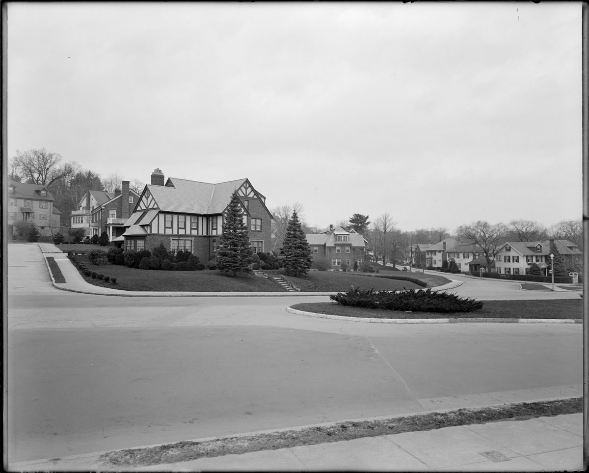
Intersection of Centre Street, May Street, and Arborway
Apr. 16, 1949; Accession No.: 08_01_000240; Courtesy of the Boston Public Library.
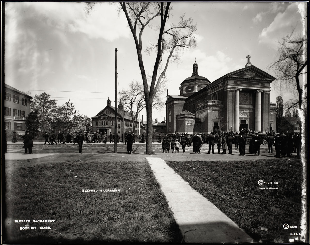
Church of the Blessed Sacrament at Centre Street and Creighton Street, circa 1930; Accession No.: 08_01_000758; Identifier: 721-A-2021; Boston Public Library.
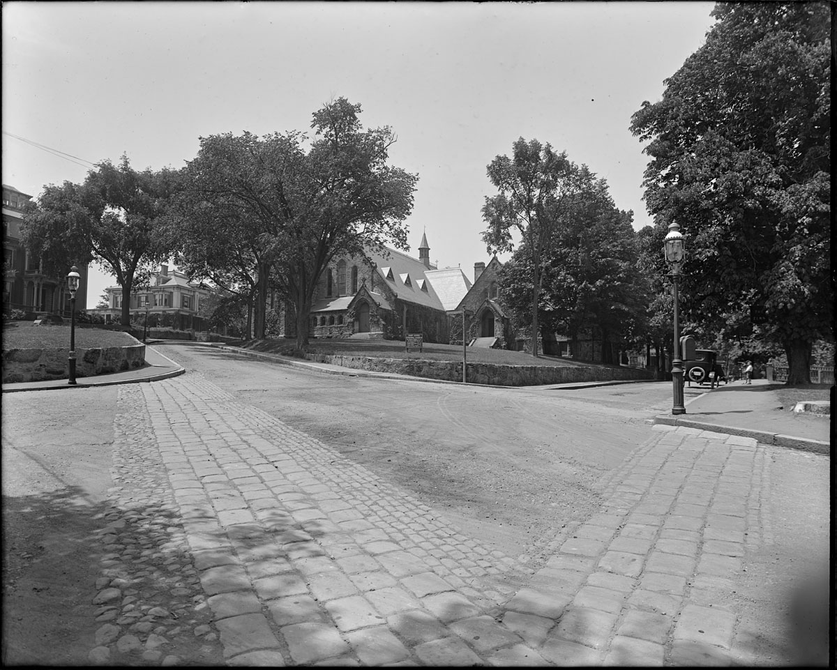
St. John Church, Jamaica Plain, Accession No.: 08_01_000327; Identifier: 2034; Courtesy of the Boston Public Library.
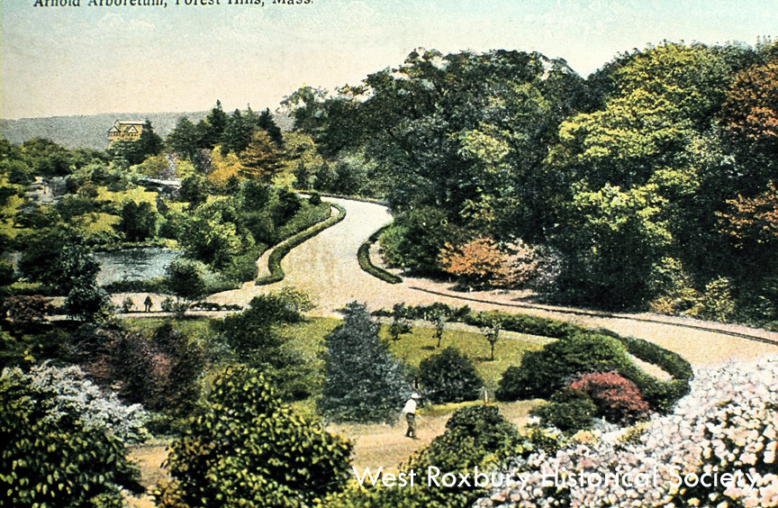
Arnold Arboretum courtesy of West Roxbury Historical Society
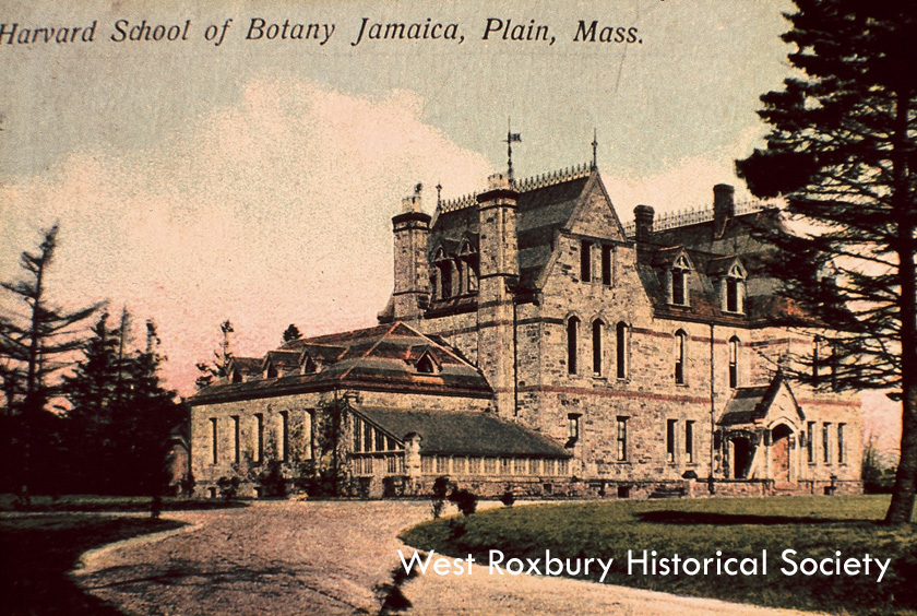
Postcard of Harvard School of Botany, courtesy of West Roxbury Historical Society.
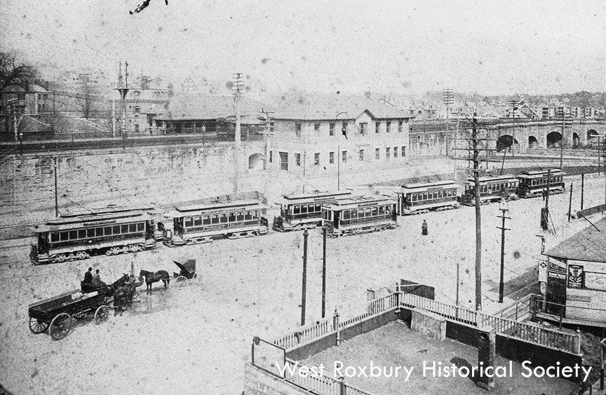
Forest Hills railroad station, ca. 1912 courtesy of West Roxbury Historical Society
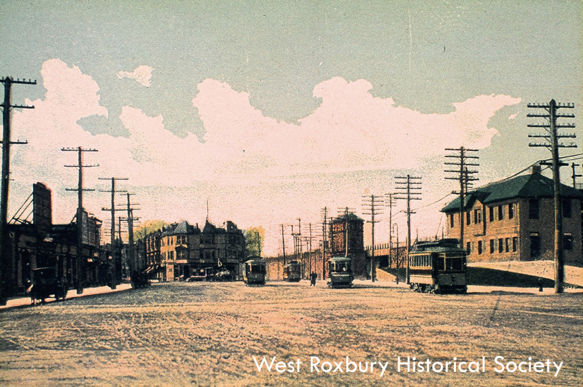
Forest Hills railroad station, ca. 1912 courtesy of West Roxbury Historical Society
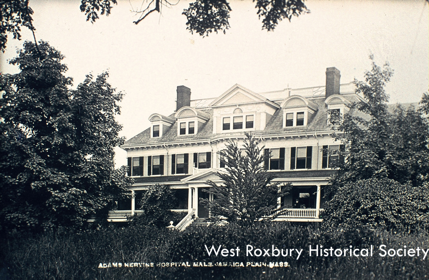
Adams-Nervine Hospital, Centre St. courtesy of West Roxbury Historical Society.
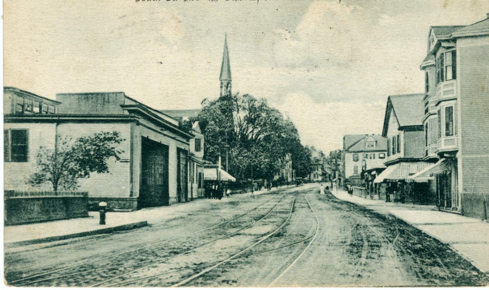
Boston Elevated streetcar barn, 125 South St.
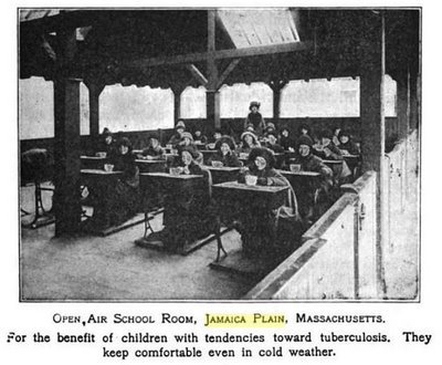
This photograph of an open air classroom in Jamaica Plain was published in the book Community Civics in 1921. This type of classroom was thought to protect children from tuberculosis infection and was part of an open air classroom movement in Europe and the United States.
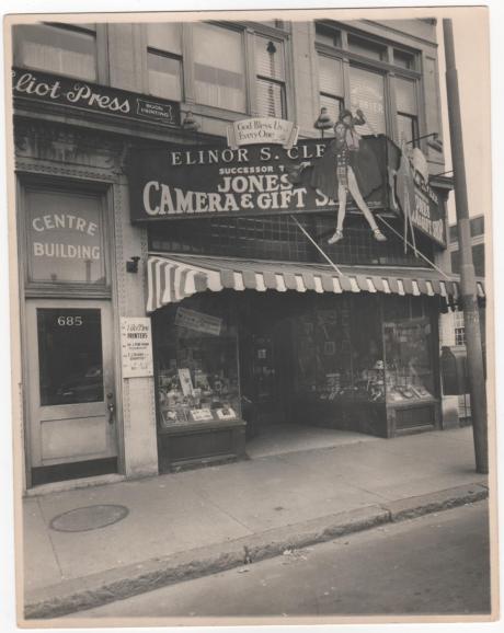
In this 1940s photo, we see Jones Card Shop on Centre Street. Photograph provided courtesy of Peter Cook.
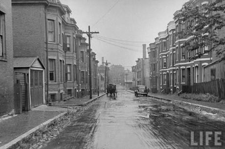
This 1945 view of Jamaica Plain was taken on Bickford Street (an area that is now a pedestrian mall in the Mildred Hailey Apartments) Dmitri Kessel/LIFE Magazine.
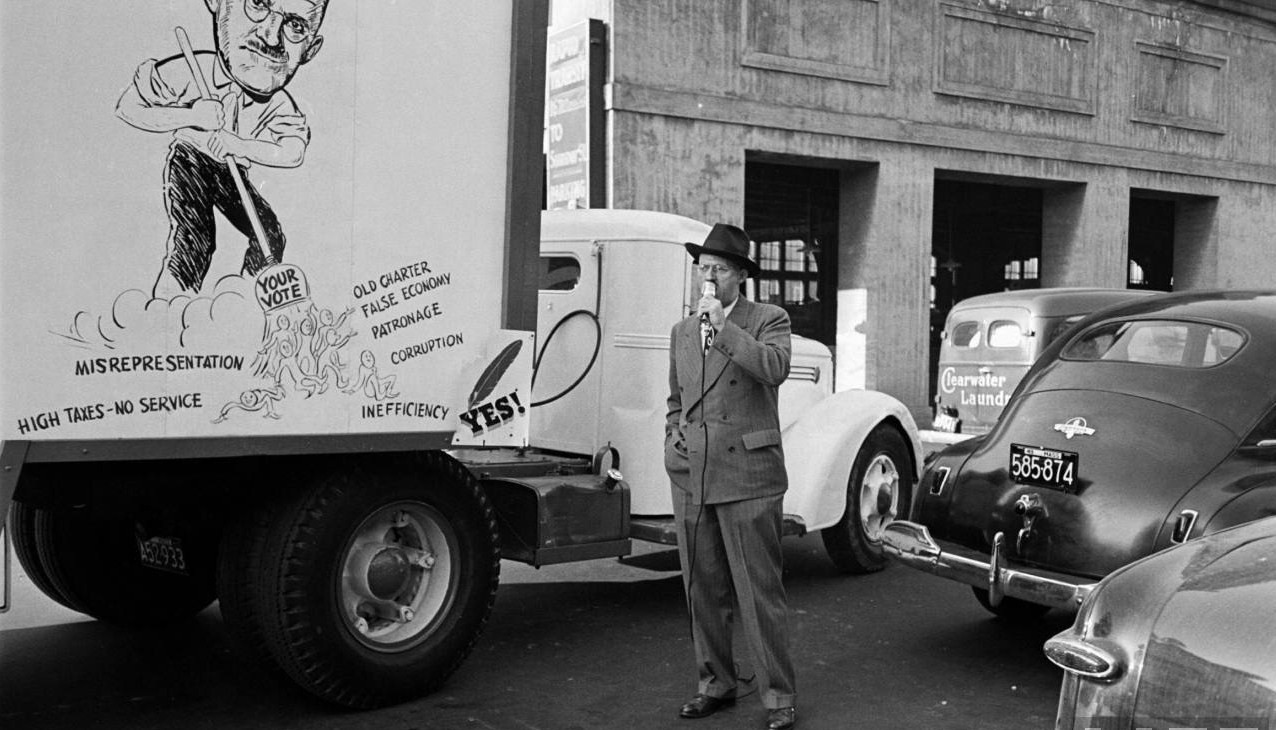
George Oakes, candidate for Boston Mayor campaigns in Jamaica Plain. Oakes was an officer at R.M. Bradley, one of Boston’s leading real estate firms. To the right of the candidate is a Clearwater Laundry delivery truck. The laundry stood on Brookside Ave. near Green St. Photograph by Yale Joel/LIFE Magazine.

The West Roxbury High School class of 1921. West Roxbury High School was located at 76 Elm St. in present day Jamaica Plain. You may also download a high-resolution version of this photograph. Courtesy of Edward Barrett.
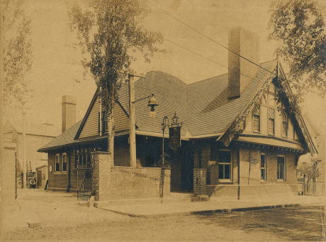
The Coffee Tree Inn stood at 14 Keyes Street (now renamed to McBride St.) and closed in 1920 as a result of Prohibition. The Boston Globe reported on the opening on June 20, 1898. The full text of that article can be read here. A high-resolution copy of this photo can be downloaded here. Photograph from JPHS archives.
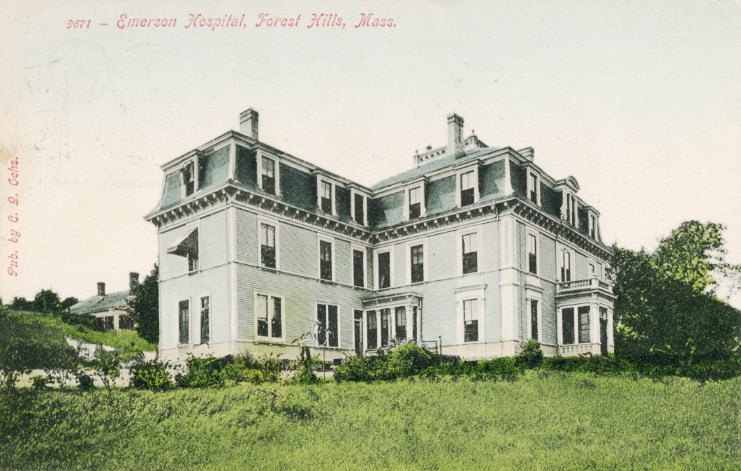
Emerson Hospital, a 42-bed institution, once stood at 118 Forest Hills St. The hospital was founded and operated by noted Homeopathic physician Nathaniel W. Emerson. The hospital was established before 1907 and appears on maps as late as 1924.
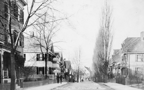
A view of Westerly Street. Courtesy of Anthony Sammarco.
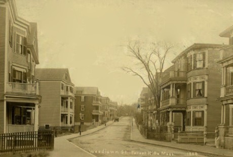
Woodlawn Street, circa 1900.
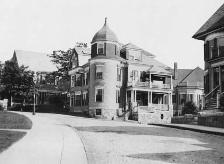
11 Belmore Terrace at the corner of Oakview Terrace. circa 1900. Photograph courtesy of Jon Truslow. Download high-resolution image.
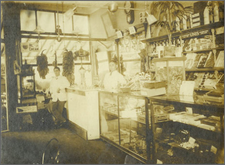
Bob’s Spa, 128 South Street. circa 1912. Download high-resolution file.
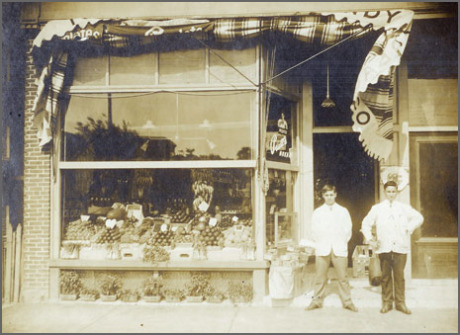
Bob Ristuccia (left) stands in front of Bob’s Spa, 128 South Street, circa 1912. Download high resolution .tif file.
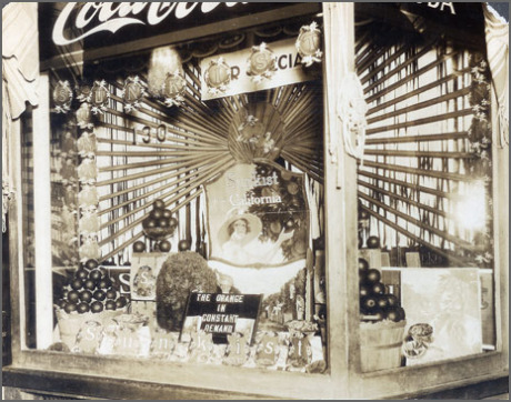
Bob’s Spa, 128 South Street. Undated. Download high resolution .tif file.
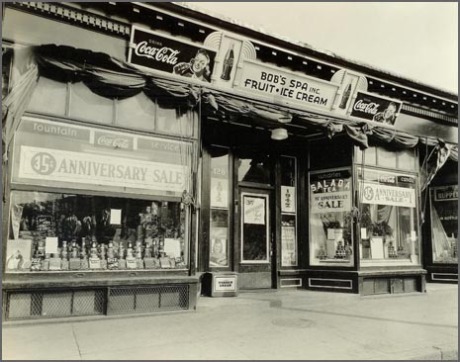
Bob’s Spa, 128 South Street, 1947. Download higher resolution image.
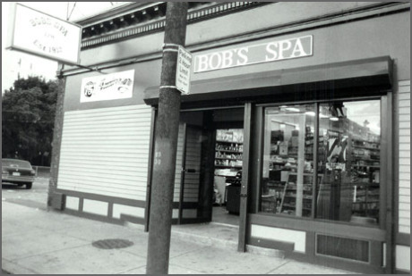
Bob’s Spa, 128 South Street, 1987. Download high resolution .tif file.
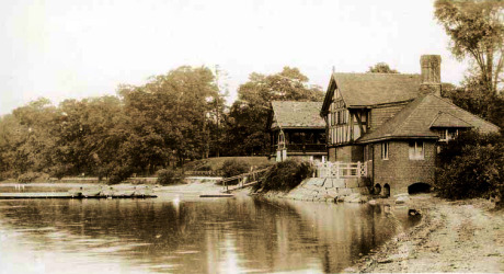
View of boat house at Jamaica Pond sometime before 1911. Image from photo postcard.
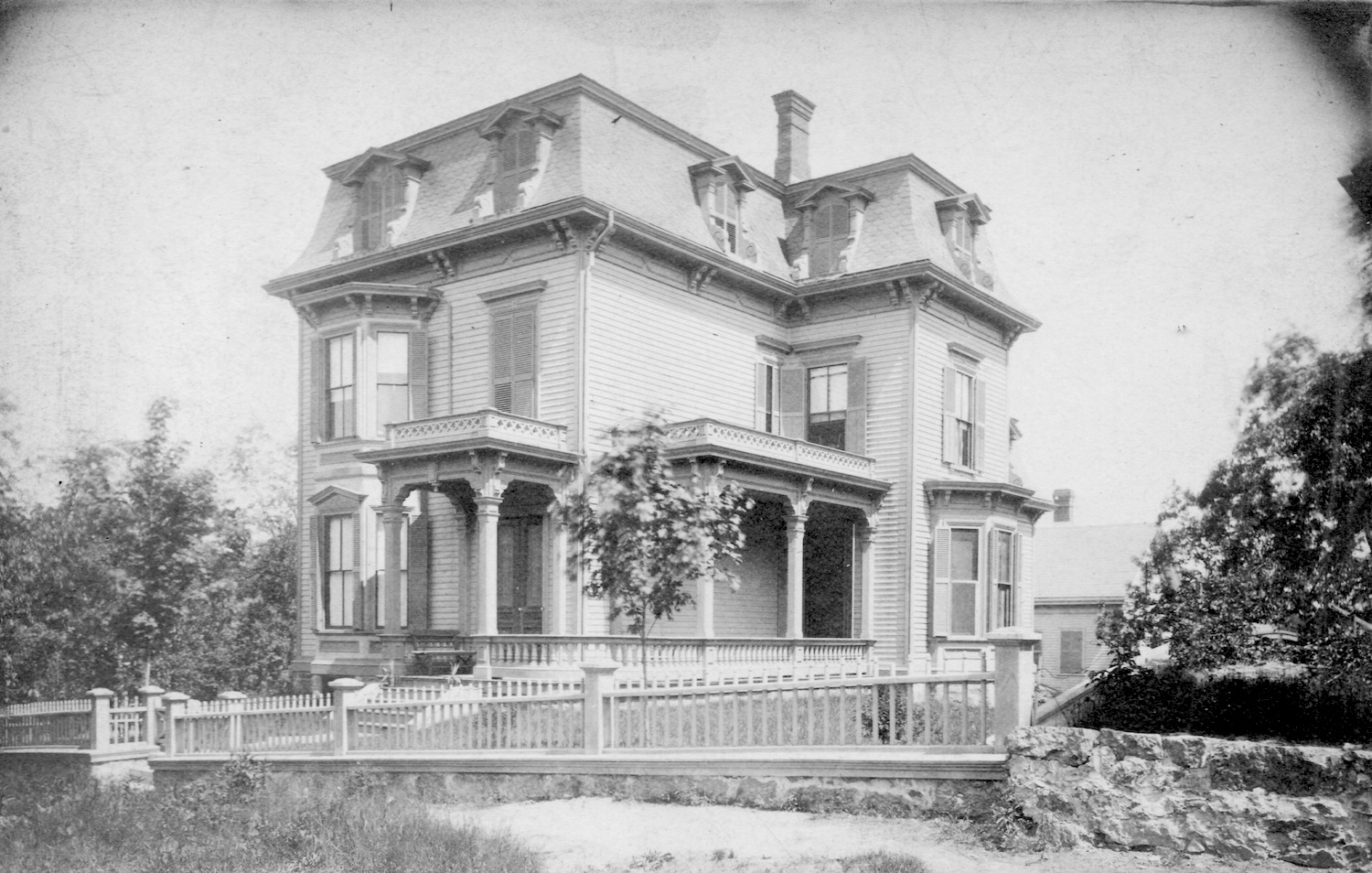
Home at the corner of Enfield and Hazel Streets (Hazel was later renamed to Robinwood Ave.) Photograph provided courtesy of Katie Knostman whose great-great-grandparents (Epaminondas Wilson and Sarah Crowell Wilson) owned and lived in the home from at least 1880-1915. Possibly 1880s to 1890s.
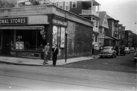
Photograph courtesy of Sarah Ratta, who writes, “This photo was taken circa 1954-1955 when my father Frank Ratta (the dark haired gentleman) returned from military service in Korea and Germany. He is standing on the corner of Hall and South Streets with a fellow serviceman and childhood friend, who grew up on Jamaica Street. I grew up at #24 Hall St, which is the fifth building down on the left.”
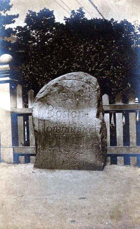
One of five mile markers that remain in the early Roxbury town limits (including West Roxbury and Jamaica Plain until 1851), untouched for the most part by politics, urban redevelopment, and other forms of change and still performing their original function. These milestones show the distance to the Boston Town House (now the Old State House). Pictured here is the five mile marker installed in 1735 and located by the monument at Centre and South Streets in Jamaica Plain. While this marker currently stands closer to the monument, it is shown here as previously located on the opposite side of street from the monument.
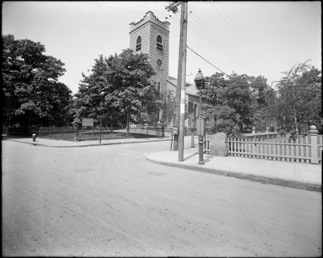
First Congregational Society (Unitarian church), corner of Centre Street and Eliot Street. ca. 1930. Photograph by Leon H. Abdalian, courtesty Boston Public Library.
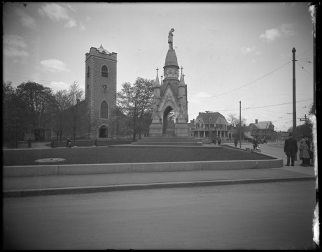
Soldier’s monument and First Congregational Church Society, Eliot Street and South Street. May, 1920. Photograph by Leon H. Abdalian, courtesty Boston Public Library.
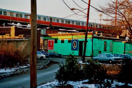
A view of Doyle’s Cafe looking down Meehan St. towards William’s St. and Washington St. Photograph copyright Ellen X. Silverberg. Used by permission. No use without written permission.

A view down Williams Street from Call St. looking towards Washington St. The old elevated Orange Line T can be seen overhead. The green building is Doyle’s Cafe. Photograph copyright Ellen X. Silverberg. Used by permission. No use without written permission.
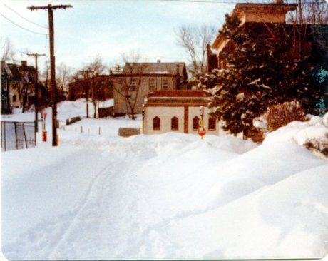
Looking down Lamartine St. towards Green. Photograph courtesy of Brian Frost.

Looking across the Johnson playground towards Lamartine. Photograph courtesy of Brian Frost.
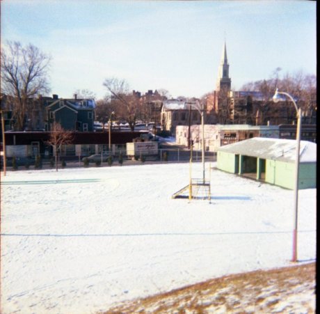
View of the Johnson playground looking towards Washington St. Photograph courtesy of Brian Frost.
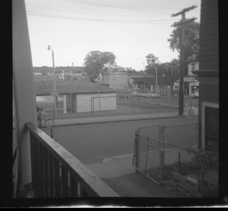
Looking across Lamartine and down Green St. towards Washington. Photograph courtesy of Brian Frost.
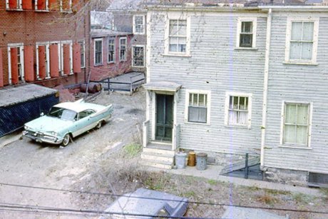
1966 view of Buff and Buff parking lot off Lamartine. Photograph courtesy of Brian Frost.
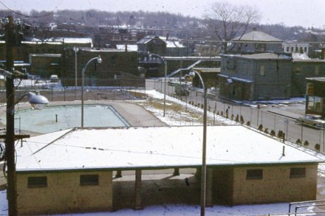
A view across the Johnson playground down Green St. towards Washington St. Photograph courtesy of Brian Frost.
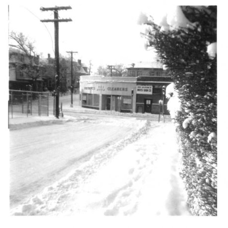
A vew down Lamartine Street towards Green St. Photograph courtesy of Brian Frost.
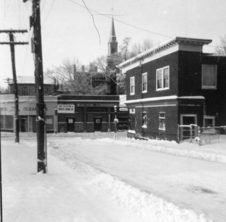
View down Lamartine St. towards Green St. Note Fredericks Cleaners, Bates Sign Company, and John Nappy Nolan’s Store. Mid-1960s. Photoraph courtesy of Brian Frost.
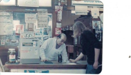
Williams Corner Market at Washington and Williams Sreet across from Doyle’s. Note the sign advertizing cigarettes for 55 cents. circa 1975. Photograph courtesy of Gary Graham.
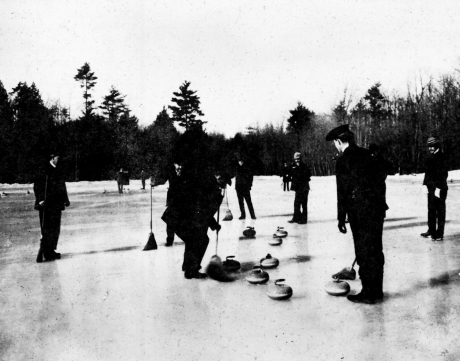
A group of men enjoy a game of curling on Jamaica Pond circa 1900. Photograph furnished courtesy of the Boston Public Library.
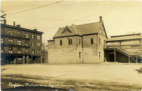
A view of Boylston Station on Boylston St. between Lamartine and Amory Streets. The building to the left housed one of the early branches of the Boston Public Library along with shops and railroad offices.
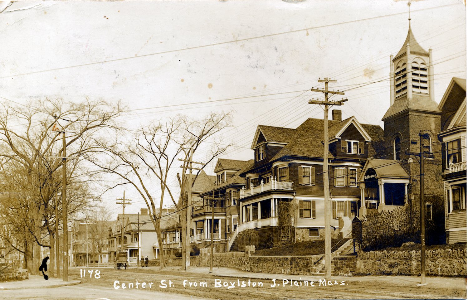
Centre St. near the intersection with Boylston St. circa 1910. Jamaica Plain Historical Society archives. Download high-resolution file.
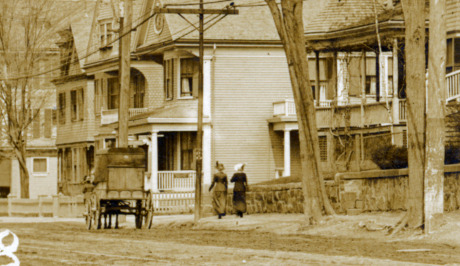
Centre St. near the intersection with Boylston St. circa 1910. Jamaica Plain Historical Society archives.
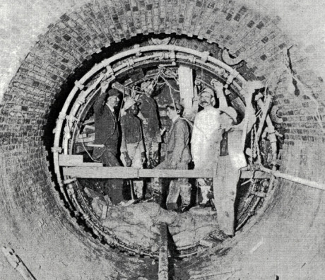
High level sewer, Centre St., Jamaica Plain. Workers are engaged in the construction of a circular tunnel using compressed air tools and a metal shield. From Metropolitan Water and Sewage Board First Annual Report. January 1, 1902.
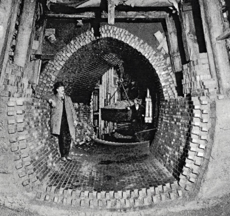
High level sewer construction in sand at Forest Hills, Jamaica Plain. Note bin suspended from overhead crane with trolley used to remove excavated dirt from tunnel. Due to the sandy nature of the soil in this area, wooden beams resting on a foundation provide support for the roadway above. From Metropolitan Water and Sewage Board First Annual Report. January 1, 1902.
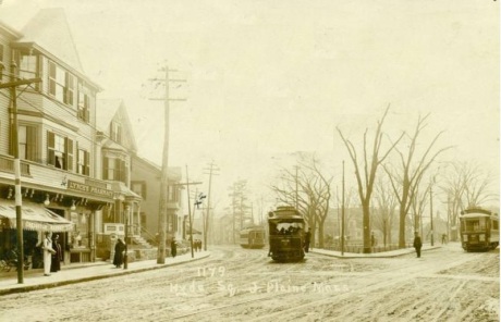
Three street cars can be seen in this view of the Hyde Square section of Jamaica Plain. The storefront on the left bears a sign, “Lynch’s Pharmacy”. The camera was positioned near Sherdian St. and Centre looking towards the Square. The two street cars on the left are traveling along Centre St.; one moving towards and the other coming from the direction of Boylston St. Day St. is to the right but can not be seen in this view. No high resolution version of this image is available. Photograph courtesy of Mark Bulger.
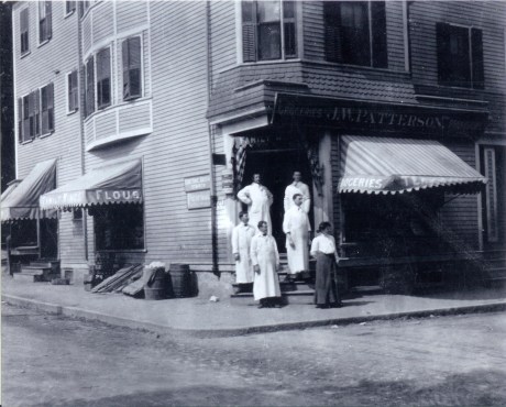
Patterson family store selling groceries and provisions on Jamaica St. Photograph courtesy of the Patterson family. A higher resolution version of this photograph is available.
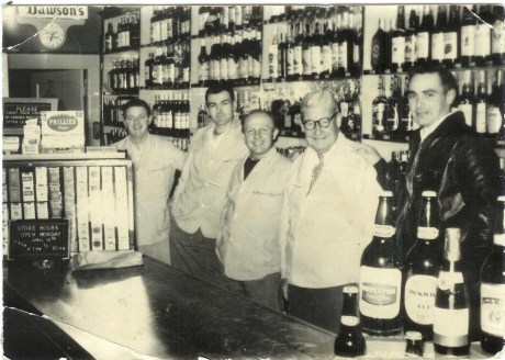
Employees of Patterson’s Liquor Store, from left to right: John Riley, Steve McCauley, Vinnie Boris, Ted Patterson, and John Patterson. Photograph courtesy of the Patterson family. A higher resolution version of this photograph is available.
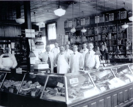
Employees of Patterson’s Market on South St. John W. Patterson stands next to the scale. George Porter is shown second from right and Josepth Patterson third from the right. Photograph provided courtesy of the Patterson family. A higher resolution version of this image is available.
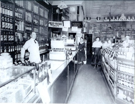
Employees of Patterson’s Market on South St. Photograph courtesy of the Patterson family. The two women shown in the middle are Alice and May Patterson. A higher resolution version of this photograph is available.
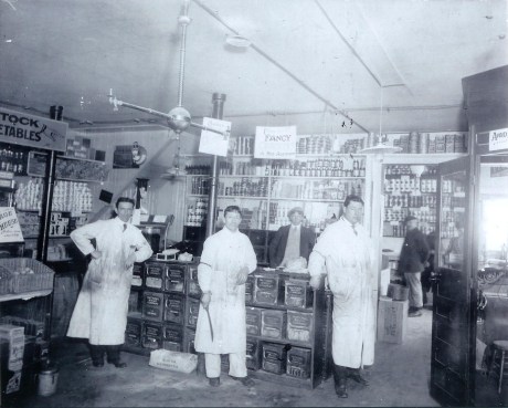
The Patterson family store selling groceries on Jamaica St. Photograph courtesy of the Patterson family. A higher resolution version of this photograph is available.
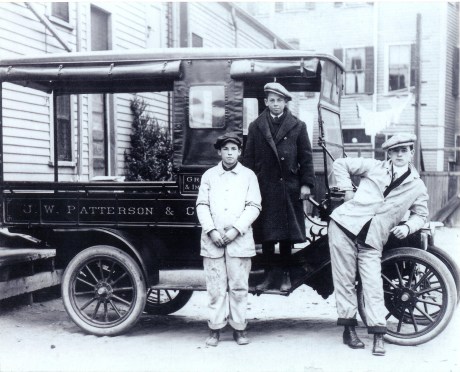
Joseph A. Patterson (middle) poses circa 1912 with two employees of Patterson’s Market in the rear of 128 South St. Photograph provided courtesy of John Patterson. Thanks also to Peter O’Brien for arranging the donation of this image. Download high-resolution image.
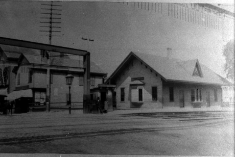
Boylston Station, Jamaica Plain. Photograph courtesy of Emy Thomas. Download high resolution image.
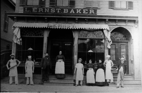
Exterior view of L. Ernst Bakery located in the vicinity of Boylston Station, Jamaica Plain. Photograph courtesy of Emy Thomas. Higher resolution versions of photographs in this set are available.
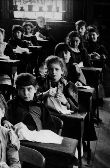
View of children in classroom. School is thought to be in the vicinity of Boylston Station, Jamaica Plain. Photograph courtesy of Emy Thomas. Higher resolution versions of photographs in this set are available.
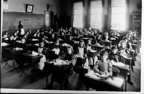
View of children in classroom. School is thought to be in the vicinity of Boylston Station, Jamaica Plain. Photograph courtesy of Emy Thomas. Higher resolution versions of photographs in this set are available.
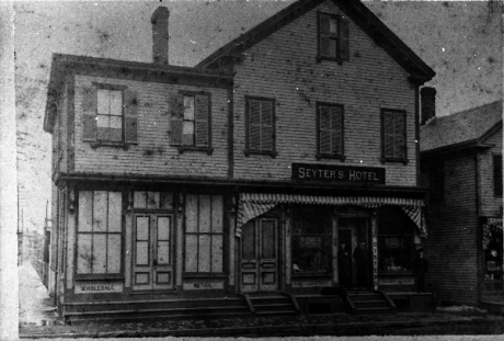
Exterior view of Seyter Hotel located in the vicinity of Boylston Station, Jamaica Plain. Photograph courtesy of Emy Thomas. Higher resolution versions of photographs in this set are available.
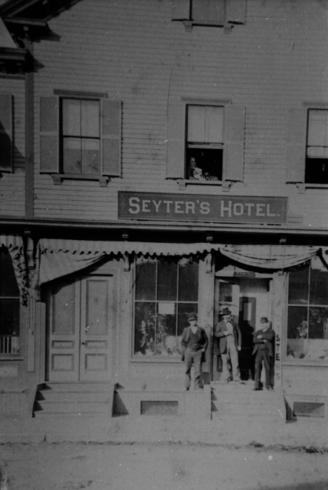
Exterior of Seyter Hotel located in the vicinity of Boylston Station, Jamaica Plain. Photograph courtesy of Emy Thomas. Higher resolution versions of photographs in this set are available.
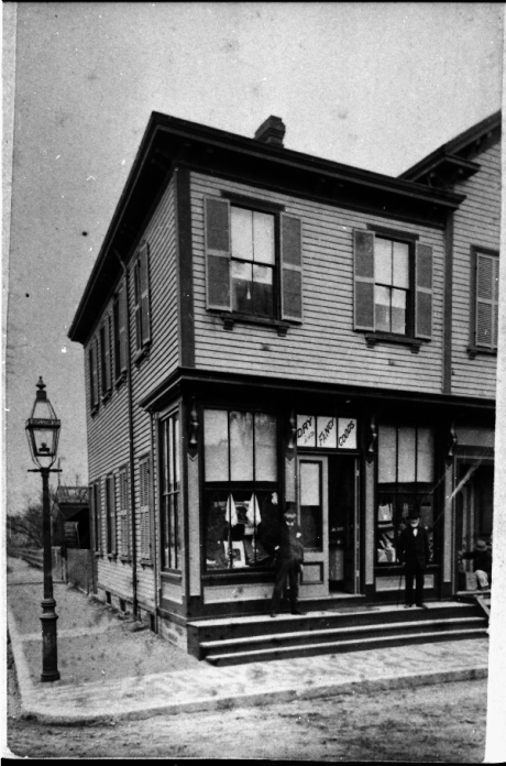
Exterior of Seyter store located in the vicinity of Boylston Station, Jamaica Plain. Sign in the window reads, “Dry and Fancy Goods”. Photograph courtesy of Emy Thomas. Higher resolution versions of photographs in this set are available.
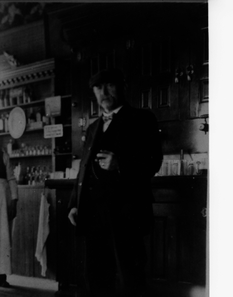
Mr. Seyter stands inside his store located in the vicinity of Boylston Station, Jamaica Plain. Photograph courtesy of Emy Thomas. Higher resolution versions of photographs in this set are available.
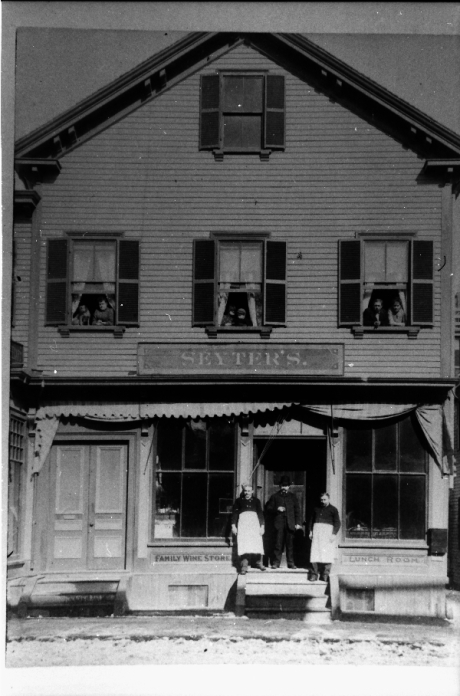
Exterior of Seyter store located in the vicinity of Boylston Station, Jamaica Plain. The sign below the window on the left reads, “Family Wine Store”. Photograph courtesy of Emy Thomas. Higher resolution versions of photographs in this set are available.


